Approximate Location Map
Large Map »
Latitude: 54.7785 / 54°46'42"N
Longitude: -1.5697 / 1°34'10"W
OS Eastings: 427777
OS Northings: 542707
OS Grid: NZ277427
Mapcode National: GBR KFG5.ZT
Mapcode Global: WHC4Q.V5Q1
Plus Code: 9C6WQCHJ+C4
Entry Name: 220, Gilesgate
Listing Date: 30 April 1971
Grade: II
Source: Historic England
Source ID: 1120614
English Heritage Legacy ID: 110247
ID on this website: 101120614
Location: The Sands, County Durham, DH1
County: County Durham
Electoral Ward/Division: Elvet and Gilesgate
Parish: City of Durham
Built-Up Area: Durham
Traditional County: Durham
Lieutenancy Area (Ceremonial County): County Durham
Church of England Parish: Durham St Nicholas
Church of England Diocese: Durham
Tagged with: Building
NZ 2742 NE
10/195
30.4.71
DURHAM AND FRAMWELLGATE
GILESGATE
(South side)
No. 220
GV
II
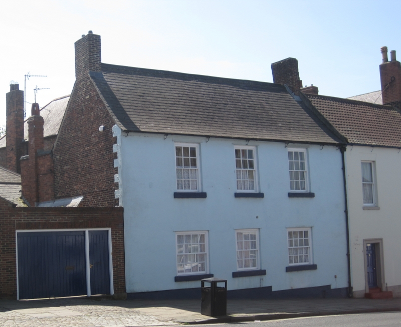
House. Mid C18. Painted incised stucco with painted ashlar dressings. Welsh
slate roof with brick chimney. 2 storeys, 3 bays. Sashes with glazing bars,
some renewed, have projecting stone sills. No door visible. Roof has swept
eaves and end chimneys.
Listing NGR: NZ2777742707
External links are from the relevant listing authority and, where applicable, Wikidata. Wikidata IDs may be related buildings as well as this specific building. If you want to add or update a link, you will need to do so by editing the Wikidata entry.


Other nearby listed buildings
