Approximate Location Map
Large Map »
Latitude: 54.7727 / 54°46'21"N
Longitude: -1.5714 / 1°34'17"W
OS Eastings: 427669
OS Northings: 542064
OS Grid: NZ276420
Mapcode National: GBR KFG7.LW
Mapcode Global: WHC4Q.T9WH
Plus Code: 9C6WQCFH+3C
Entry Name: 31, 32 and 33, Church Street
Listing Date: 30 April 1971
Grade: II
Source: Historic England
Source ID: 1120680
English Heritage Legacy ID: 110104
ID on this website: 101120680
Location: The Sands, County Durham, DH1
County: County Durham
Electoral Ward/Division: Elvet and Gilesgate
Parish: City of Durham
Built-Up Area: Durham
Traditional County: Durham
Lieutenancy Area (Ceremonial County): County Durham
Church of England Parish: Durham St Oswald
Church of England Diocese: Durham
Tagged with: Building
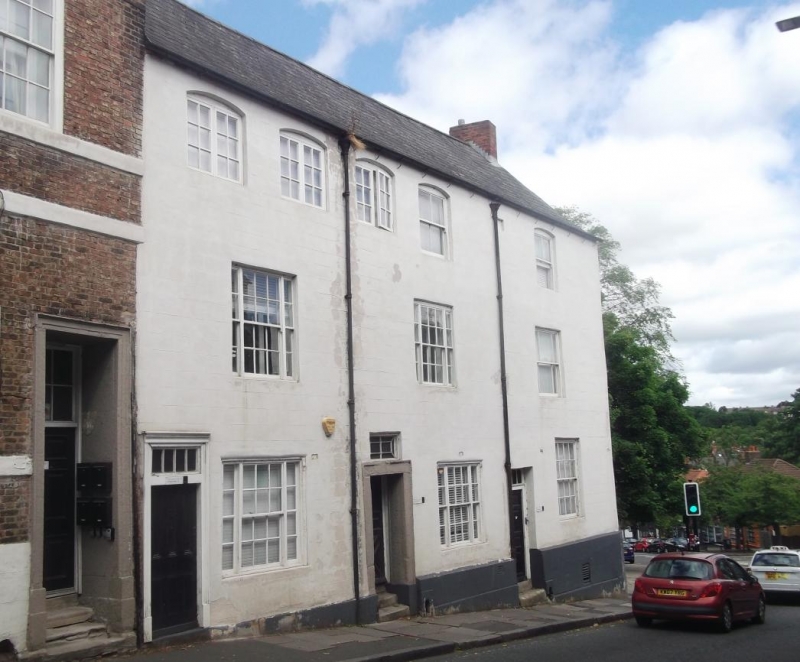
DURHAM AND FRAMWELLGATE CHURCH STREET
NZ 2742 SE (West side)
15/55 Nos. 31, 32 and 33
30/4/71
GV II
3 houses. Mid C18. Painted incised stucco with painted ashlar dressings and
plinth; roof of dark asbestos tiles with renewed brick chimney. 3 storeys,
6 bays.
Doors in first bays; No. 31 has 3-over-3 panels under 4-paned overlight in
architrave; No. 32 has 2 internal steps up to door with diagonal lower and 4
upper panels, recessed in wide architrave with patterned overlight above; one
internal step up to door of No. 30 which has 8 panels under 4-paned overlight
in plain reveal. Tripartite sashes with glazing bars on ground and first floors
of Nos. 31 and 32; No. 33 has sashes with glazing bars on ground floor, margined
sashes on first floor. Second floor has horizontal sliding sashes in 3 left bays,
one late C19 sash at right of No. 32 and one similar sash in No. 33, all with
segmental heads. Right end brick chimney. Boot scraper recesses beside doors.
Listing NGR: NZ2766942064
External links are from the relevant listing authority and, where applicable, Wikidata. Wikidata IDs may be related buildings as well as this specific building. If you want to add or update a link, you will need to do so by editing the Wikidata entry.


Other nearby listed buildings
