Approximate Location Map
Large Map »
Latitude: 54.7752 / 54°46'30"N
Longitude: -1.575 / 1°34'29"W
OS Eastings: 427438
OS Northings: 542340
OS Grid: NZ274423
Mapcode National: GBR KFF7.T0
Mapcode Global: WHC4Q.S76K
Plus Code: 9C6WQCGG+32
Entry Name: 4, Owengate
Listing Date: 19 February 1970
Grade: II
Source: Historic England
Source ID: 1121378
English Heritage Legacy ID: 110397
ID on this website: 101121378
Location: Durham, County Durham, DH1
County: County Durham
Electoral Ward/Division: Elvet and Gilesgate
Parish: City of Durham
Built-Up Area: Durham
Traditional County: Durham
Lieutenancy Area (Ceremonial County): County Durham
Tagged with: Building
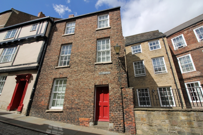
DURHAM AND FRAMWELLGATE OWENGATE
NZ 2742 SW (North side)
14/343 No. 4
19.2.70
GV II
House. Late C18. English garden wall bond brick (3 and 1) with painted
ashlar dressings; roof not visible. 3 storeys, 2 bays. Internal step up
to 4-panelled door at right under flat brick arch; similar arches and
projecting stone sills to sashes with glazing bars. Left end chimney raised
in new brick. Square gas lamp attached on iron bracket.
Listing NGR: NZ2743842340
External links are from the relevant listing authority and, where applicable, Wikidata. Wikidata IDs may be related buildings as well as this specific building. If you want to add or update a link, you will need to do so by editing the Wikidata entry.


Other nearby listed buildings
