Approximate Location Map
Large Map »
Latitude: 51.6187 / 51°37'7"N
Longitude: -0.7174 / 0°43'2"W
OS Eastings: 488893
OS Northings: 191879
OS Grid: SU888918
Mapcode National: GBR D5C.KFL
Mapcode Global: VHDW5.JK2Y
Plus Code: 9C3XJ79M+F2
Entry Name: Red Lion Cafe
Listing Date: 28 June 1973
Grade: II
Source: Historic England
Source ID: 1125146
English Heritage Legacy ID: 46110
ID on this website: 101125146
Location: Wycombe Marsh, Buckinghamshire, HP11
County: Buckinghamshire
Electoral Ward/Division: Ryemead
Parish: Non Civil Parish
Built-Up Area: High Wycombe
Traditional County: Buckinghamshire
Lieutenancy Area (Ceremonial County): Buckinghamshire
Church of England Parish: High Wycombe Saint Anne and Saint Peter
Church of England Diocese: Oxford
Tagged with: Building
LONDON ROAD
1.
963
(South Side)
Red Lion Cafe
SU 8891 NE 4/287
II
2.
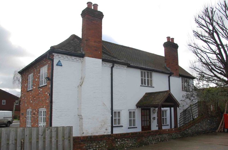
C18 with earlier back wing. Painted brick, old tile roofs, hipped in front
with corbelled brick cornice. 2 storeys, 4 flush casements, modern glazing
and wide ground floor window. Cut bracketed door hood.
Listing NGR: SU8889391879
External links are from the relevant listing authority and, where applicable, Wikidata. Wikidata IDs may be related buildings as well as this specific building. If you want to add or update a link, you will need to do so by editing the Wikidata entry.


Other nearby listed buildings
