Approximate Location Map
Large Map »
Latitude: 52.2007 / 52°12'2"N
Longitude: 0.1334 / 0°8'0"E
OS Eastings: 545892
OS Northings: 257971
OS Grid: TL458579
Mapcode National: GBR L79.Y90
Mapcode Global: VHHK3.8YCB
Plus Code: 9F42642M+78
Entry Name: Hughes Hall
Listing Date: 2 November 1972
Grade: II
Source: Historic England
Source ID: 1126027
English Heritage Legacy ID: 47895
ID on this website: 101126027
Location: Romsey Town, Cambridge, Cambridgeshire, CB1
County: Cambridgeshire
District: Cambridge
Electoral Ward/Division: Petersfield
Parish: Non Civil Parish
Built-Up Area: Cambridge
Traditional County: Cambridgeshire
Lieutenancy Area (Ceremonial County): Cambridgeshire
Church of England Parish: Cambridge St Barnabas
Church of England Diocese: Ely
Tagged with: Building University building
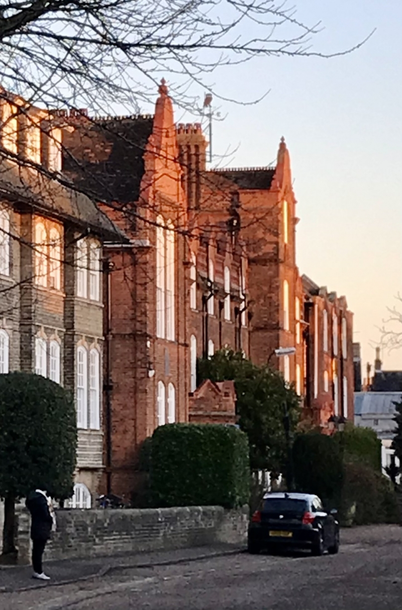
WOLLASTON ROAD
1.
942
Hughes Hall
TL 4557 17/712
II
2.
1894-5. By Fawcett. In the Neo-Dutch manner. Red brick. 3 storeys.
Canted bay windows on the ground floor, mullion and transom windows above.
Tiled roof with shaped gables.
Listing NGR: TL4589257970
External links are from the relevant listing authority and, where applicable, Wikidata. Wikidata IDs may be related buildings as well as this specific building. If you want to add or update a link, you will need to do so by editing the Wikidata entry.


Other nearby listed buildings
