Approximate Location Map
Large Map »
Latitude: 52.208 / 52°12'28"N
Longitude: 0.1296 / 0°7'46"E
OS Eastings: 545612
OS Northings: 258778
OS Grid: TL456587
Mapcode National: GBR L79.HLF
Mapcode Global: VHHK3.6RCQ
Plus Code: 9F42645H+5R
Entry Name: 27-33, Maid's Causeway
Listing Date: 2 November 1972
Grade: II
Source: Historic England
Source ID: 1126165
English Heritage Legacy ID: 47591
ID on this website: 101126165
Location: Cambridge, Cambridgeshire, CB5
County: Cambridgeshire
District: Cambridge
Electoral Ward/Division: Market
Parish: Non Civil Parish
Built-Up Area: Cambridge
Traditional County: Cambridgeshire
Lieutenancy Area (Ceremonial County): Cambridgeshire
Church of England Parish: Cambridge St Andrew the Less
Church of England Diocese: Ely
Tagged with: Building
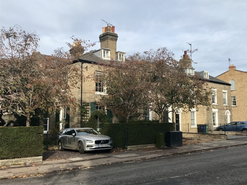
MAID'S CAUSEWAY
1.
942
(North Side)
Nos 27 to 33 (odd)
TL 4558 NE 5/566
II
2.
Circa 1825. Grey gault brick. 2 storeys and basement, 2 windows, sashes
mostly with glazing bars. Panelled doors with rectangular lights over.
Slate roofs. (RCHM 267).
Listing NGR: TL4561258778
External links are from the relevant listing authority and, where applicable, Wikidata. Wikidata IDs may be related buildings as well as this specific building. If you want to add or update a link, you will need to do so by editing the Wikidata entry.


Other nearby listed buildings
