Approximate Location Map
Large Map »
Latitude: 52.2129 / 52°12'46"N
Longitude: 0.1123 / 0°6'44"E
OS Eastings: 544413
OS Northings: 259293
OS Grid: TL444592
Mapcode National: GBR L78.C5P
Mapcode Global: VHHK2.WMQX
Plus Code: 9F426476+5W
Entry Name: 83, Castle Street
Listing Date: 2 November 1972
Grade: II
Source: Historic England
Source ID: 1126234
English Heritage Legacy ID: 47387
ID on this website: 101126234
Location: Cambridge, Cambridgeshire, CB3
County: Cambridgeshire
District: Cambridge
Electoral Ward/Division: Castle
Parish: Non Civil Parish
Built-Up Area: Cambridge
Traditional County: Cambridgeshire
Lieutenancy Area (Ceremonial County): Cambridgeshire
Church of England Parish: Cambridge The Ascension
Church of England Diocese: Ely
Tagged with: House
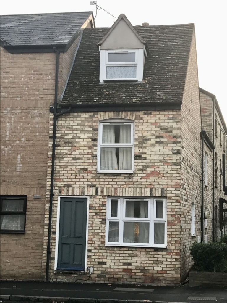
CASTLE STREET
1.
942
(West Side)
No 83
TL 4459 15/452
II
2.
C17 or earlier. Timber-framed, re-faced completely in grey gault brick
in the early C19 2 storeys and attic, 1 window to street, modern casement
on ground floor, sash window above, pedimented dormer. Panelled C19 door.
Tiled roof. (RCITI 215).
Listing NGR: TL4441359293
External links are from the relevant listing authority and, where applicable, Wikidata. Wikidata IDs may be related buildings as well as this specific building. If you want to add or update a link, you will need to do so by editing the Wikidata entry.


Other nearby listed buildings
