Approximate Location Map
Large Map »
Latitude: 52.3362 / 52°20'10"N
Longitude: 0.3364 / 0°20'11"E
OS Eastings: 559281
OS Northings: 273475
OS Grid: TL592734
Mapcode National: GBR N8P.FW0
Mapcode Global: VHHJM.SJ6W
Plus Code: 9F4288PP+FH
Entry Name: 11, Pratt Street
Listing Date: 17 November 1983
Grade: II
Source: Historic England
Source ID: 1126414
English Heritage Legacy ID: 48877
ID on this website: 101126414
Location: Soham, East Cambridgeshire, CB7
County: Cambridgeshire
District: East Cambridgeshire
Civil Parish: Soham
Built-Up Area: Soham
Traditional County: Cambridgeshire
Lieutenancy Area (Ceremonial County): Cambridgeshire
Church of England Parish: Soham St Andrew
Church of England Diocese: Ely
Tagged with: Building
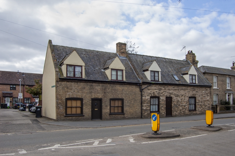
TL 5973 SOHAM PRATT STREET
(West Side)
13/71 No. 11
GV
II
Cottage, late C18 or early C19. Clunch but front wall cased in
gault brick. Steeply pitched slate roof. One storey and
attics. Two dormers. Segmental arches to two window openings,
and one doorway, all now boarded up. (1983).
Listing NGR: TL5928173475
External links are from the relevant listing authority and, where applicable, Wikidata. Wikidata IDs may be related buildings as well as this specific building. If you want to add or update a link, you will need to do so by editing the Wikidata entry.


Other nearby listed buildings
