Approximate Location Map
Large Map »
Latitude: 53.6921 / 53°41'31"N
Longitude: -1.7449 / 1°44'41"W
OS Eastings: 416944
OS Northings: 421765
OS Grid: SE169217
Mapcode National: GBR JT8R.17
Mapcode Global: WHC9W.5GCF
Plus Code: 9C5WM7R4+R3
Entry Name: Calder and Hebble Navigation Brearley Bridge Kirklees Cut Brearley Bridge
Listing Date: 29 September 1978
Grade: II
Source: Historic England
Source ID: 1134345
English Heritage Legacy ID: 339635
ID on this website: 101134345
Location: Kirklees, West Yorkshire, HD2
County: Kirklees
Electoral Ward/Division: Brighouse
Parish: Non Civil Parish
Traditional County: Yorkshire
Lieutenancy Area (Ceremonial County): West Yorkshire
Church of England Parish: Bradley St Thomas
Church of England Diocese: Leeds
Tagged with: Bridge
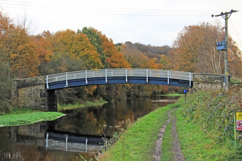
CALDER AND HEBBLE NAVIGATION
1.
5113
KIRKLEES CUT CUT
SE 1621 8/288 Brearley Bridge
II
2.
1895. Hammer-dressed stone ramps, parapet and cylindrical piers. Single segmental
span. Steel, paved with stone setts. Plaque with "Leeds Steel Works Ltd
Builders 1895".
Listing NGR: SE1694421764
External links are from the relevant listing authority and, where applicable, Wikidata. Wikidata IDs may be related buildings as well as this specific building. If you want to add or update a link, you will need to do so by editing the Wikidata entry.


Other nearby listed buildings
