Approximate Location Map
Large Map »
Latitude: 50.2121 / 50°12'43"N
Longitude: -5.4794 / 5°28'45"W
OS Eastings: 151859
OS Northings: 40472
OS Grid: SW518404
Mapcode National: GBR DXV3.WFM
Mapcode Global: VH12D.ZX4S
Plus Code: 9C2P6G6C+R7
Entry Name: 1, 2 and 3, St Andrews Street
Listing Date: 22 December 1972
Grade: II
Source: Historic England
Source ID: 1136929
English Heritage Legacy ID: 69080
ID on this website: 101136929
Location: St Ives, Cornwall, TR26
County: Cornwall
Civil Parish: St. Ives
Built-Up Area: St Ives
Traditional County: Cornwall
Lieutenancy Area (Ceremonial County): Cornwall
Church of England Parish: St Ives
Church of England Diocese: Truro
Tagged with: Building
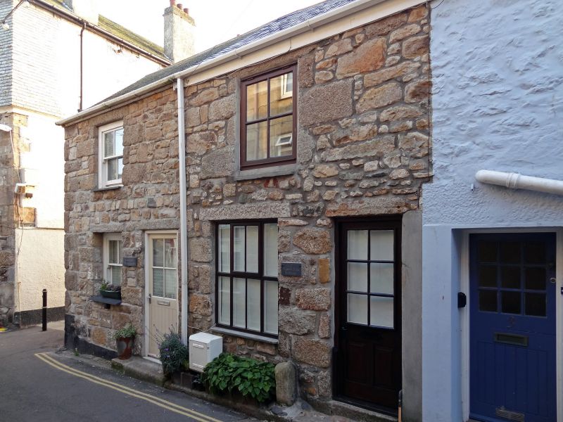
ST ANDREW'S STREET
1. (East Side)
1587 ------------------
Nos 1, 2 and 3
SW 54 SW 1/125
II
2.
C18/19. Rubble (No 3 is painted). Two storeys, three widely spaced windows,
sashes, no glazing bars. Two small modern shop fronts. Slurried slate
roof with gable ends. Two rubble wings at rear, single storey with tarred
hipped roofs, one with modern balcony on end wall.
Listing NGR: SW5185940472
External links are from the relevant listing authority and, where applicable, Wikidata. Wikidata IDs may be related buildings as well as this specific building. If you want to add or update a link, you will need to do so by editing the Wikidata entry.


Other nearby listed buildings
