Approximate Location Map
Large Map »
Latitude: 50.2147 / 50°12'52"N
Longitude: -5.4805 / 5°28'49"W
OS Eastings: 151792
OS Northings: 40760
OS Grid: SW517407
Mapcode National: GBR DXV3.NFT
Mapcode Global: VH12D.YVKT
Plus Code: 9C2P6G79+VR
Entry Name: 4, 6 and 8, Virgin Street
Listing Date: 22 December 1972
Grade: II
Source: Historic England
Source ID: 1137000
English Heritage Legacy ID: 69136
ID on this website: 101137000
Location: St Ives, Cornwall, TR26
County: Cornwall
Civil Parish: St. Ives
Built-Up Area: St Ives
Traditional County: Cornwall
Lieutenancy Area (Ceremonial County): Cornwall
Church of England Parish: St Ives
Church of England Diocese: Truro
Tagged with: Building
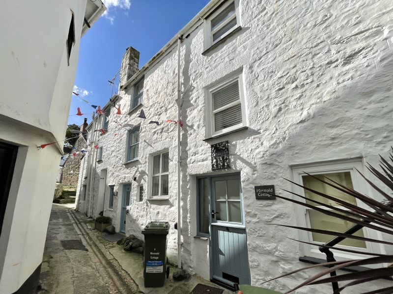
VIRGIN STREET
1. (North-East Side)
1587 -----------------
Nos 4, 6 and 8
SW 54 SW 1/166
II
2.
C18. Painted granite rubble. Three storeys. Four windows. Renewed
sashes, no glazing bars. Modern glazed doors. Steep slurried slate hipped
roof. Group value.
All the listed buildings in Virgin Street form a group.
Listing NGR: SW5179240760
External links are from the relevant listing authority and, where applicable, Wikidata. Wikidata IDs may be related buildings as well as this specific building. If you want to add or update a link, you will need to do so by editing the Wikidata entry.


Other nearby listed buildings
