Approximate Location Map
Large Map »
Latitude: 53.2532 / 53°15'11"N
Longitude: -2.8655 / 2°51'55"W
OS Eastings: 342351
OS Northings: 373254
OS Grid: SJ423732
Mapcode National: GBR 8ZFT.FK
Mapcode Global: WH881.YHMF
Plus Code: 9C5V743M+7Q
Entry Name: Sundial, South West of Church of St Lawrence
Listing Date: 20 December 1983
Grade: II
Source: Historic England
Source ID: 1138372
English Heritage Legacy ID: 55418
ID on this website: 101138372
Location: St Lawrence's Church, Stoak, Cheshire West and Chester, Cheshire, CH2
County: Cheshire West and Chester
Civil Parish: Stoak
Traditional County: Cheshire
Lieutenancy Area (Ceremonial County): Cheshire
Church of England Parish: Ellesmere Port Team
Church of England Diocese: Chester
SJ 47SW
4/35
STOAK C.P.
CHURCHYARD
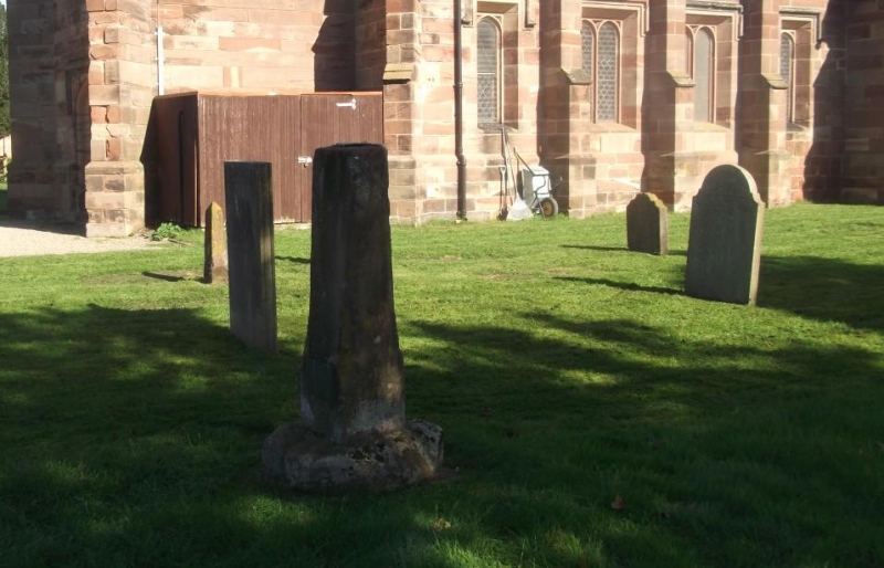
Sundial, south west of Church of St Lawrence
II
GV
Sundial. Probably C17th. Red sandstone, octagonal chamfered pillar on
octagonal base. Very worn. Remains of brass sundial cemented into
top. Side has plaque, 1978 to churchwardens John Cheers and Dick
Kinsey.
Listing NGR: SJ 42351 73254
External links are from the relevant listing authority and, where applicable, Wikidata. Wikidata IDs may be related buildings as well as this specific building. If you want to add or update a link, you will need to do so by editing the Wikidata entry.


Other nearby listed buildings
