Approximate Location Map
Large Map »
Latitude: 50.215 / 50°12'54"N
Longitude: -5.4806 / 5°28'50"W
OS Eastings: 151783
OS Northings: 40801
OS Grid: SW517408
Mapcode National: GBR DXV3.NCF
Mapcode Global: VH12D.YVGJ
Plus Code: 9C2P6G89+2P
Entry Name: 14, 16 and 18, Digey Street
Listing Date: 22 December 1972
Grade: II
Source: Historic England
Source ID: 1143369
English Heritage Legacy ID: 68974
ID on this website: 101143369
Location: St Ives, Cornwall, TR26
County: Cornwall
Civil Parish: St. Ives
Built-Up Area: St Ives
Traditional County: Cornwall
Lieutenancy Area (Ceremonial County): Cornwall
Church of England Parish: St Ives
Church of England Diocese: Truro
Tagged with: Building
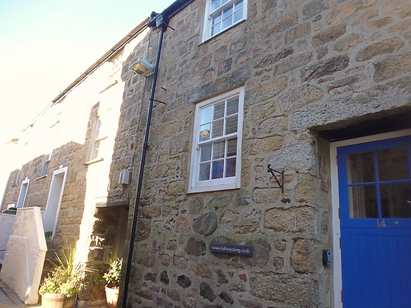
DIGEY STREET
1. (North-east Side)
1587 -----------------
Nos 14, 16 and 18
SW 54 SW 1/59
II GV
2.
C18/19. Coursed granite. three storeys. Five windows, sashes with
glazing bars. Ground floor Stares, steps up to first floor doors. No
14 has original shutters. Passageway through centre. Slurried slate
roof.
All the listed building from Nos 12 to 32 (even) form a group.
Listing NGR: SW5178340801
External links are from the relevant listing authority and, where applicable, Wikidata. Wikidata IDs may be related buildings as well as this specific building. If you want to add or update a link, you will need to do so by editing the Wikidata entry.


Other nearby listed buildings
