Approximate Location Map
Large Map »
Latitude: 50.105 / 50°6'17"N
Longitude: -5.5766 / 5°34'35"W
OS Eastings: 144351
OS Northings: 28890
OS Grid: SW443288
Mapcode National: GBR DXMD.LDJ
Mapcode Global: VH05H.9M7D
Plus Code: 9C2P4C3F+X9
Entry Name: Milestone at SW443288
Listing Date: 15 December 1988
Grade: II
Source: Historic England
Source ID: 1143959
English Heritage Legacy ID: 69564
ID on this website: 101143959
Location: Drift, Cornwall, TR19
County: Cornwall
Civil Parish: Paul
Traditional County: Cornwall
Lieutenancy Area (Ceremonial County): Cornwall
Church of England Parish: Paul
Church of England Diocese: Truro
Tagged with: Milestone
PAUL
SW 42 NW
5/6 Milestone at SW443288
- II
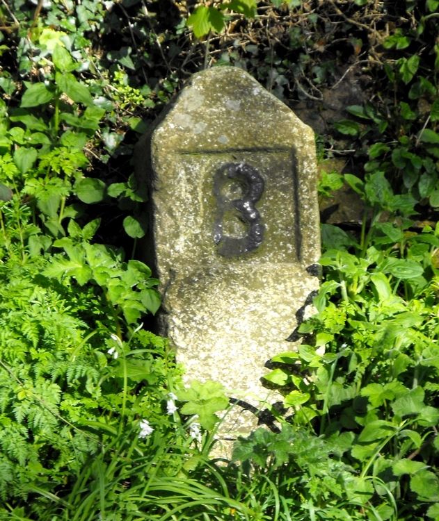
Milestone. C18. Dressed granite monolith with pyramidal head. Square on plan.
Road face has the Arabic numeral 8 in relief set within a rectangular recessed panel.
Listing NGR: SW4435228890
External links are from the relevant listing authority and, where applicable, Wikidata. Wikidata IDs may be related buildings as well as this specific building. If you want to add or update a link, you will need to do so by editing the Wikidata entry.


Other nearby listed buildings
