Approximate Location Map
Large Map »
Latitude: 54.6643 / 54°39'51"N
Longitude: -2.7516 / 2°45'5"W
OS Eastings: 351619
OS Northings: 530173
OS Grid: NY516301
Mapcode National: GBR 9G7H.2R
Mapcode Global: WH81B.P1X3
Plus Code: 9C6VM67X+P9
Entry Name: 2-4, St Andrew's Churchyard
Listing Date: 9 February 1983
Grade: II
Source: Historic England
Source ID: 1145051
English Heritage Legacy ID: 72926
ID on this website: 101145051
Location: Penrith, Westmorland and Furness, Cumbria, CA11
County: Cumbria
District: Eden
Civil Parish: Penrith
Built-Up Area: Penrith
Traditional County: Cumberland
Lieutenancy Area (Ceremonial County): Cumbria
Church of England Parish: Penrith St Andrew
Church of England Diocese: Carlisle
Tagged with: Building
1.
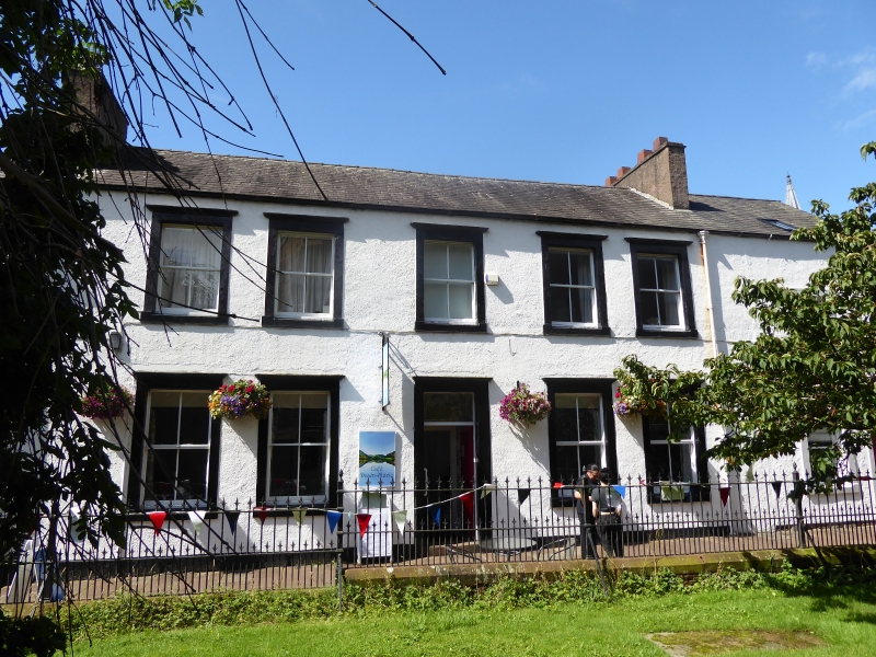
5165 ST ANDREW'S CHURCHYARD
Nos 2 to 4 (consec)
NY 5130 1/173
II GV
2.
C19, roughcast over stone; 2 storeys. No 2 has a sash and a large modern
window on ground floor and 3 sashes above. No 3 has a centre door, 2 windows
down and 5 up, all with cornices. No 4 has 1 window on each floor.
Listing NGR: NY5162030176
External links are from the relevant listing authority and, where applicable, Wikidata. Wikidata IDs may be related buildings as well as this specific building. If you want to add or update a link, you will need to do so by editing the Wikidata entry.


Other nearby listed buildings
