Approximate Location Map
Large Map »
Latitude: 54.6634 / 54°39'48"N
Longitude: -2.753 / 2°45'10"W
OS Eastings: 351528
OS Northings: 530076
OS Grid: NY515300
Mapcode National: GBR 9G6J.S2
Mapcode Global: WH81B.P18S
Plus Code: 9C6VM67W+9R
Entry Name: 6-12, Corn Market
Listing Date: 9 February 1983
Grade: II
Source: Historic England
Source ID: 1145121
English Heritage Legacy ID: 72810
ID on this website: 101145121
Location: Penrith, Westmorland and Furness, Cumbria, CA11
County: Cumbria
District: Eden
Civil Parish: Penrith
Built-Up Area: Penrith
Traditional County: Cumberland
Lieutenancy Area (Ceremonial County): Cumbria
Church of England Parish: Penrith St Andrew
Church of England Diocese: Carlisle
Tagged with: Building
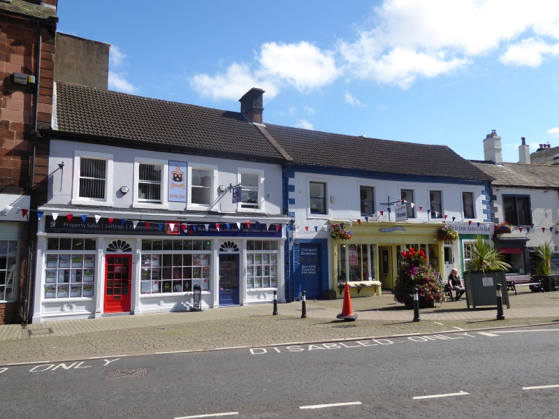
1.
5165 CORN MARKET
Nos 6 to 12 (consec)
NY 5130 1/61
II GV
2.
C17 and C18. Painted stucco over stone, 2 storeys. Quoins. Shop fronts
inserted in ground floor. Sash windows above in plain stone architraves.
Nos 9 and 10 have moulded eaves cornice. No 12 has double sashes. No 11 has
low old doorway (now a window) with lintel inscribed 1624.
Listing NGR: NY5152830076
External links are from the relevant listing authority and, where applicable, Wikidata. Wikidata IDs may be related buildings as well as this specific building. If you want to add or update a link, you will need to do so by editing the Wikidata entry.


Other nearby listed buildings
