Approximate Location Map
Large Map »
Latitude: 51.6303 / 51°37'49"N
Longitude: -0.7508 / 0°45'2"W
OS Eastings: 486562
OS Northings: 193129
OS Grid: SU865931
Mapcode National: GBR D54.P0W
Mapcode Global: VHDW4.X9Z1
Plus Code: 9C3XJ6JX+4M
Entry Name: 7, Castle Street
Listing Date: 28 June 1973
Grade: II*
Source: Historic England
Source ID: 1159695
English Heritage Legacy ID: 45974
ID on this website: 101159695
Location: High Wycombe, Buckinghamshire, HP13
County: Buckinghamshire
Electoral Ward/Division: Abbey
Parish: Non Civil Parish
Built-Up Area: High Wycombe
Traditional County: Buckinghamshire
Lieutenancy Area (Ceremonial County): Buckinghamshire
Church of England Parish: High Wycombe All Saints
Church of England Diocese: Oxford
Tagged with: Building
CASTLE STREET
1.
963
No 7
SU 8693 SE 2/31
II* GV
2.
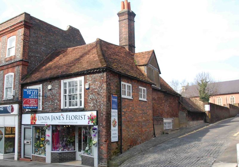
Formerly shown as Premises adjoining and immediatcly east of No 5. C18
front to earlier building. Vitreous bricks with red brick dressings. 2
storeys with dentil brick eaves cornice, old tiled hipped roof. 2 upper
flush set sash windows with side lights and glazing bars. Ground floor
has 2 modern shops with cornices Rw+st front has 2 small upper casement
windows and central chimney stack with offset head. Timber framed red
brick nogged east gable, plastered north gable. Interior: crown post roof,
probably C14, and remains of plastered smoke bay.
Priory House Annexe and Nos 1 to 7 (odd) form a group.
Listing NGR: SU8656293129
External links are from the relevant listing authority and, where applicable, Wikidata. Wikidata IDs may be related buildings as well as this specific building. If you want to add or update a link, you will need to do so by editing the Wikidata entry.


Other nearby listed buildings
