Approximate Location Map
Large Map »
Latitude: 54.7713 / 54°46'16"N
Longitude: -1.5697 / 1°34'11"W
OS Eastings: 427777
OS Northings: 541901
OS Grid: NZ277419
Mapcode National: GBR KFG8.YF
Mapcode Global: WHC4Q.VBPM
Plus Code: 9C6WQCCJ+G4
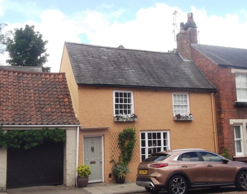
Entry Name: 73, Hallgarth Street
Listing Date: 10 March 1988
Grade: II
Source: Historic England
Source ID: 1160089
English Heritage Legacy ID: 110261
ID on this website: 101160089
Location: County Durham, DH1
County: County Durham
Electoral Ward/Division: Elvet and Gilesgate
Parish: City of Durham
Built-Up Area: Durham
Traditional County: Durham
Lieutenancy Area (Ceremonial County): County Durham
Church of England Parish: Durham St Oswald
Church of England Diocese: Durham
Tagged with: Building
DURHAM AND FRAMWELLGATE HALLGARTH STREET
NZ 2741 NE (West side)
17/209 No. 73
GV II
House. C18. Rough render; Welsh slate roof with brick chimneys. 2 storeys,
2 windows. Door at left has 3 over 3 panels under hood; tripartite sash at
right and 2 first-floor sashes with glazing bars. Roof has slightly swept
eaves; right end chimney.
Listing NGR: NZ2777741901
External links are from the relevant listing authority and, where applicable, Wikidata. Wikidata IDs may be related buildings as well as this specific building. If you want to add or update a link, you will need to do so by editing the Wikidata entry.


Other nearby listed buildings
