Approximate Location Map
Large Map »
Latitude: 53.6192 / 53°37'8"N
Longitude: -2.3724 / 2°22'20"W
OS Eastings: 375466
OS Northings: 413688
OS Grid: SD754136
Mapcode National: GBR CVWL.5C
Mapcode Global: WH97P.J9JB
Plus Code: 9C5VJJ9H+M3
Entry Name: Old Cross
Listing Date: 27 January 1967
Last Amended: 19 August 1986
Grade: II
Source: Historic England
Source ID: 1162874
English Heritage Legacy ID: 210563
ID on this website: 101162874
Location: Affetside, Bury, Greater Manchester, BL8
County: Bury
Electoral Ward/Division: North Manor
Parish: Non Civil Parish
Traditional County: Lancashire
Lieutenancy Area (Ceremonial County): Greater Manchester
Church of England Parish: Holcombe and Hawkshaw
Church of England Diocese: Manchester
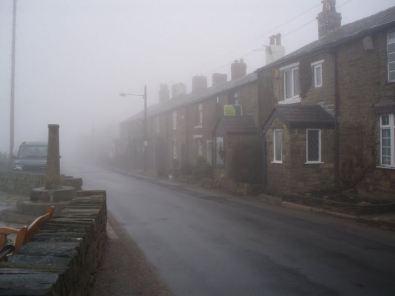
SOUTH TURTON WATLING STREET
SD 71 SE (west side)
Affetside
6/83 Old Cross
(Formerly listed as
27.1.67 Old Cross, Affetside)
- II
Cross base with later shaft. Probably medieval, the shaft
possibly C18. Stone. 3 circular steps and roughly cut
Tuscan column. Mortise cut in top. Probably a market cross.
Listing NGR: SD7546613688
External links are from the relevant listing authority and, where applicable, Wikidata. Wikidata IDs may be related buildings as well as this specific building. If you want to add or update a link, you will need to do so by editing the Wikidata entry.


Other nearby listed buildings
