Approximate Location Map
Large Map »
Latitude: 50.7238 / 50°43'25"N
Longitude: -3.535 / 3°32'6"W
OS Eastings: 291743
OS Northings: 92698
OS Grid: SX917926
Mapcode National: GBR P0.PYLV
Mapcode Global: FRA 37H5.6MP
Plus Code: 9C2RPFF7+GX
Entry Name: 5 and 6, Iron Bridge
Listing Date: 18 June 1974
Grade: II
Source: Historic England
Source ID: 1170611
English Heritage Legacy ID: 89279
ID on this website: 101170611
Location: Exeter, Devon, EX4
County: Devon
District: Exeter
Electoral Ward/Division: St David's
Parish: Non Civil Parish
Built-Up Area: Exeter
Traditional County: Devon
Lieutenancy Area (Ceremonial County): Devon
Church of England Parish: Exeter St David
Church of England Diocese: Exeter
Tagged with: Building
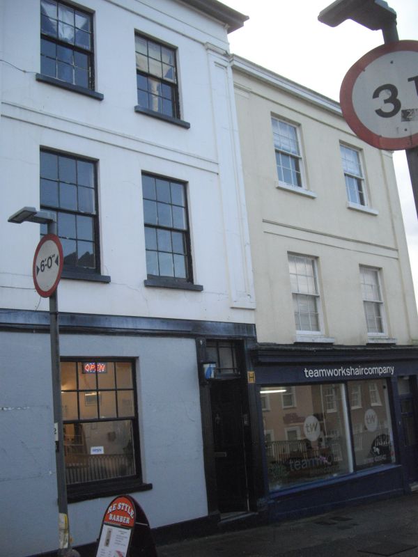
IRON BRIDGE
1.
l092
Nos 5 and 6
SX 9192 NE 2/230
II
2.
Early C19. 3 storeys 2 window stucco fronts, with bands, pilasters to upper floors.
No 6 has a contemporary shop front. (NB No 6 is built on the top of No 53 Lower
North Street, which forms two storeys below the Iron Bridge roadway level).
All the listed buildings of Iron Bridge form a group.
Listing NGR: SX9174392698
External links are from the relevant listing authority and, where applicable, Wikidata. Wikidata IDs may be related buildings as well as this specific building. If you want to add or update a link, you will need to do so by editing the Wikidata entry.


Other nearby listed buildings
