Approximate Location Map
Large Map »
Latitude: 52.5355 / 52°32'7"N
Longitude: -2.4178 / 2°25'3"W
OS Eastings: 371760
OS Northings: 293151
OS Grid: SO717931
Mapcode National: GBR BZ.F7J8
Mapcode Global: VH90Z.1JPN
Plus Code: 9C4VGHPJ+5V
Entry Name: 3-5, 6 (incorporating former No 7), 8-10, 11 (incorporating former No 12) and 13 Cartway
Listing Date: 1 February 1974
Last Amended: 19 January 1977
Grade: II
Source: Historic England
Source ID: 1177129
English Heritage Legacy ID: 254357
ID on this website: 101177129
Location: Bridgnorth, Shropshire, WV16
County: Shropshire
Civil Parish: Bridgnorth
Built-Up Area: Bridgnorth
Traditional County: Shropshire
Lieutenancy Area (Ceremonial County): Shropshire
Church of England Parish: Bridgnorth
Church of England Diocese: Hereford
Tagged with: Building
This list entry was subject to a Minor Amendment on 1 June 2022 to reformat the text to current standards
SO 79 SW
2/19
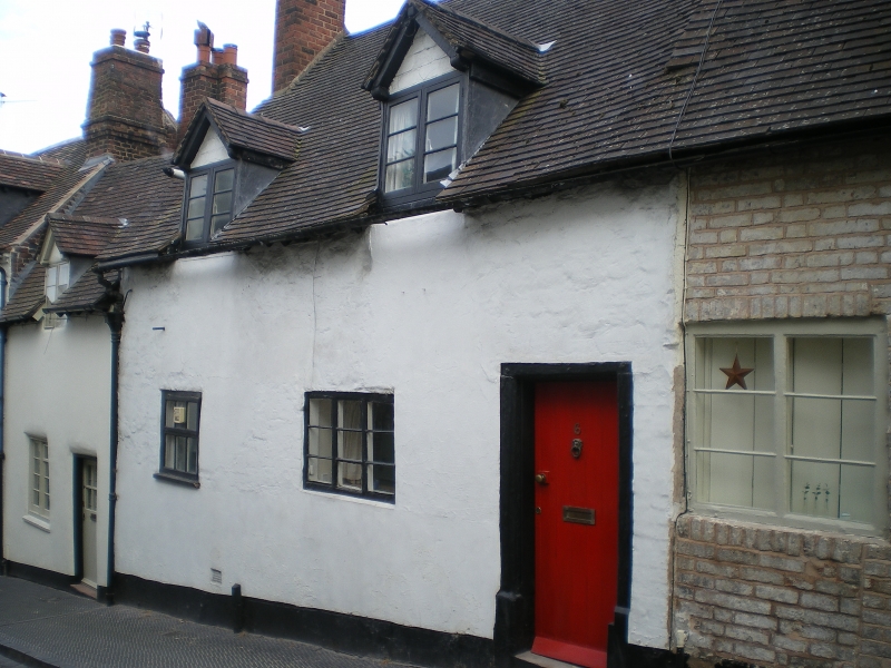
BRIDGNORTH
CARTWAY (south and west side)
Nos 3 to 5 (consec), No 6 (incorporating former No 7), Nos 8 to 10 (consec), No 11 (incorporating former No 12), No 13
(Formerly listed as Nos 3 to 13 (consec))
GV
II
C17-C18. Colourwashed brick; one and two storeys various windows, with shutters to ground floor; old tile roof. Picturesque. Included for group value.
Methodist Church, Nos 2 to 14 (consec), 16 to 26 (consec) and 29 to 32 (consec) form a group
Listing NGR: SO7176093151
External links are from the relevant listing authority and, where applicable, Wikidata. Wikidata IDs may be related buildings as well as this specific building. If you want to add or update a link, you will need to do so by editing the Wikidata entry.


Other nearby listed buildings
