Approximate Location Map
Large Map »
Latitude: 51.7498 / 51°44'59"N
Longitude: -1.259 / 1°15'32"W
OS Eastings: 451247
OS Northings: 205943
OS Grid: SP512059
Mapcode National: GBR 8Z4.6HN
Mapcode Global: VHCXV.487X
Plus Code: 9C3WPPXR+W9
Entry Name: 8, Brewer Street
Listing Date: 12 January 1954
Grade: II
Source: Historic England
Source ID: 1185289
English Heritage Legacy ID: 245345
ID on this website: 101185289
Location: Oxford, Oxfordshire, OX1
County: Oxfordshire
District: Oxford
Electoral Ward/Division: Carfax
Parish: Non Civil Parish
Built-Up Area: Oxford
Traditional County: Oxfordshire
Lieutenancy Area (Ceremonial County): Oxfordshire
Church of England Parish: Oxford St Ebbe with Holy Trinity and St Peter le Bailey
Church of England Diocese: Oxford
Tagged with: Building
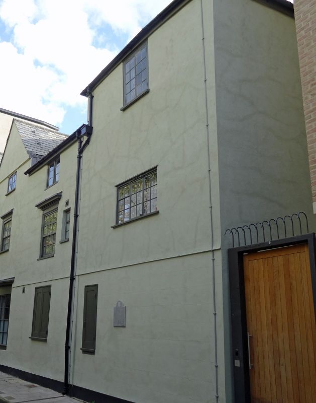
BREWER STREET
1.
1485
(South Side)
No 8
SP 5l05 NW 12/588 12.1.54.
II
2.
House. C18 front and probably of the same original building with No 7 (qv).
Similar facade and the ground floor is stuccoed and some of the windows have
simpler frames. The back is roughcast but has a C17 appearance.
Listing NGR: SP5124805939
External links are from the relevant listing authority and, where applicable, Wikidata. Wikidata IDs may be related buildings as well as this specific building. If you want to add or update a link, you will need to do so by editing the Wikidata entry.


Other nearby listed buildings
