Approximate Location Map
Large Map »
Latitude: 54.4947 / 54°29'41"N
Longitude: -1.4663 / 1°27'58"W
OS Eastings: 434664
OS Northings: 511177
OS Grid: NZ346111
Mapcode National: GBR LJ6G.BJ
Mapcode Global: WHD78.F9Z3
Plus Code: 9C6WFGVM+VF
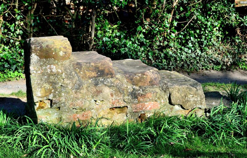
Entry Name: Mounting Block About 15 Metres South West of Church of St John the Baptist
Listing Date: 27 January 1988
Grade: II
Source: Historic England
Source ID: 1185928
English Heritage Legacy ID: 350450
ID on this website: 101185928
Location: Low Dinsdale, Darlington, County Durham, DL2
County: Darlington
Civil Parish: Neasham
Traditional County: Durham
Lieutenancy Area (Ceremonial County): County Durham
Church of England Parish: Dinsdale
Church of England Diocese: Durham
Tagged with: Mounting block
LOW DINSDALE LOW DINSDALE
NZ 31 SW (East side)
8/47 Mounting block
about 15 metres
south-west of
Church of St. John
the Baptist
II
Mounting block. Probably C18. Rubble base patched with brick and rendered
on sides. 5 squared stone steps.
Listing NGR: NZ3466411177
External links are from the relevant listing authority and, where applicable, Wikidata. Wikidata IDs may be related buildings as well as this specific building. If you want to add or update a link, you will need to do so by editing the Wikidata entry.


Other nearby listed buildings
