Approximate Location Map
Large Map »
Latitude: 53.5685 / 53°34'6"N
Longitude: -2.8858 / 2°53'8"W
OS Eastings: 341431
OS Northings: 408347
OS Grid: SD414083
Mapcode National: GBR 8W95.0J
Mapcode Global: WH86H.NK0Q
Plus Code: 9C5VH497+9M
Entry Name: Cornerstone
Listing Date: 18 January 1972
Last Amended: 1 March 1993
Grade: II
Source: Historic England
Source ID: 1197068
English Heritage Legacy ID: 386418
ID on this website: 101197068
Location: Ormskirk, West Lancashire, L39
County: Lancashire
District: West Lancashire
Electoral Ward/Division: Scott
Parish: Non Civil Parish
Built-Up Area: Ormskirk
Traditional County: Lancashire
Lieutenancy Area (Ceremonial County): Lancashire
Church of England Parish: Ormskirk St Peter and St Paul
Church of England Diocese: Liverpool
Tagged with: Building
ORMSKIRK
SD4108SW THE STILES
663-1/7/177 (North side)
18/01/72 No.15
Cornerstone
(Formerly Listed as:
BURSCOUGH STREET
(West side)
No.29A)
GV II
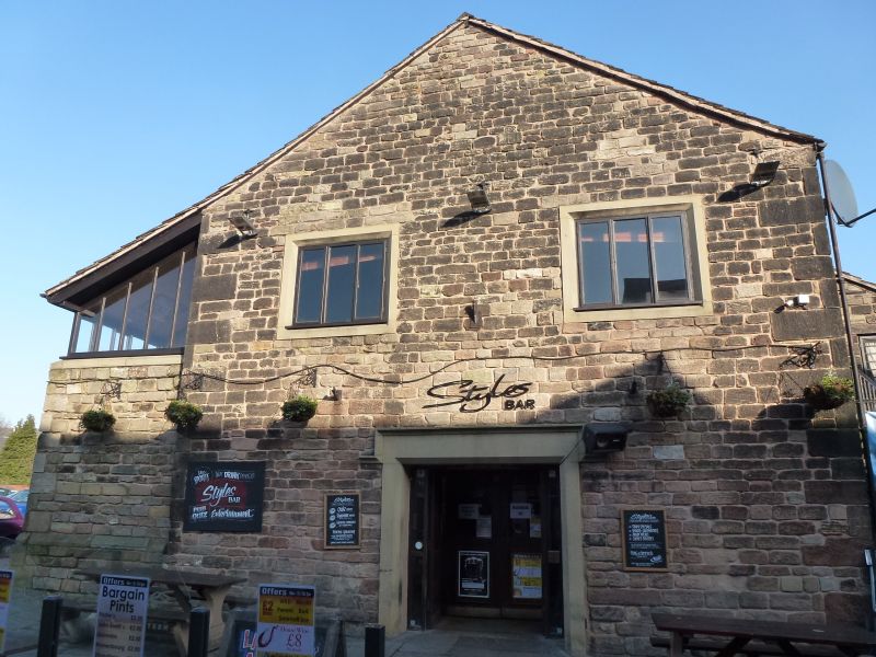
Building of unknown function, in process of conversion as
restaurant at time of survey. Probably late C17 or very early
C18; altered in early C19 and subsequently.
Coursed squared sandstone with quoins, stone slate roof.
Cruciform plan formed by main range of 3 structural bays on
north-south axis, with east and west outshuts to the centre.
Now 2 storeys, slightly raised, but perhaps formerly one tall
storey; with a high chamfered plinth to all sides except the
south end.
The east and west sides of the north end of the main range
each have a tall cross-window with chamfered flush mullion and
transom and cavetto-moulded hoodmould, and next to this (left
and right respectively) a segmental-headed doorway, that on
the west side now enclosed by a widening of the outshut which
abuts the right-hand jamb of the cross-window, and itself has
a 2-light mullioned window also with a chamfered flush
mullion.
The north gable wall, which is very thick, terminates below
the present roof line (which has a shallower pitch) the top
portion of the wall being stepped back and rendered.
The south side of the east outshut has openings to both
floors: a C19 window on each floor, and a doorway at 1st floor
approached by recently-altered steps.
The south side of the west outshut has recently been extended
to the south-west corner; and the south gable (the entrance
front) has recently inserted openings.
INTERIOR: the north bay has a higher floor, and vacant sockets
in the masonry suggest it was formerly partitioned from the
centre by timber-framing partition; the west outshut has a
timber lintel (or wallplate of formerly lower eaves) and the
east outshut formerly had a similar lintel; the early
extension to the west outshut contains a stone bowl or piscina
built into the wall below the 2-light window; and the roof has
two C19 queen-post trusses of bolted softwood.
Listing NGR: SD4143108347
External links are from the relevant listing authority and, where applicable, Wikidata. Wikidata IDs may be related buildings as well as this specific building. If you want to add or update a link, you will need to do so by editing the Wikidata entry.


Other nearby listed buildings
