Approximate Location Map
Large Map »
Latitude: 51.3899 / 51°23'23"N
Longitude: 1.3825 / 1°22'57"E
OS Eastings: 635428
OS Northings: 171083
OS Grid: TR354710
Mapcode National: GBR WZS.VRC
Mapcode Global: VHLG6.XB7B
Plus Code: 9F3399QM+X2
Entry Name: 16, King Street
Listing Date: 22 February 1973
Grade: II
Source: Historic England
Source ID: 1203726
English Heritage Legacy ID: 356605
ID on this website: 101203726
Location: Margate, Thanet, Kent, CT9
County: Kent
District: Thanet
Electoral Ward/Division: Margate Central
Parish: Non Civil Parish
Built-Up Area: Margate
Traditional County: Kent
Lieutenancy Area (Ceremonial County): Kent
Tagged with: Building
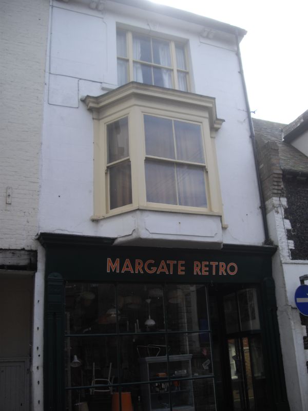
KING STREET
1.
1380
(South Side)
No 16
TR 3571 SW 2/219
II GV
2.
Mid C19. 3 storeys stuccoed. Wide bracket cornice 1 3-light window, bay
on 1st floor. Late C19 shopfront.
Nos 16 to 32 (even) form a group
Listing NGR: TR3542871083
External links are from the relevant listing authority and, where applicable, Wikidata. Wikidata IDs may be related buildings as well as this specific building. If you want to add or update a link, you will need to do so by editing the Wikidata entry.


Other nearby listed buildings
