Approximate Location Map
Large Map »
Latitude: 51.3912 / 51°23'28"N
Longitude: 1.3812 / 1°22'52"E
OS Eastings: 635331
OS Northings: 171220
OS Grid: TR353712
Mapcode National: GBR WZS.N1W
Mapcode Global: VHLG6.W9KC
Plus Code: 9F3399RJ+FF
Entry Name: Droit House
Listing Date: 22 February 1973
Grade: II
Source: Historic England
Source ID: 1204115
English Heritage Legacy ID: 356684
ID on this website: 101204115
Location: Margate, Thanet, Kent, CT9
County: Kent
District: Thanet
Electoral Ward/Division: Margate Central
Parish: Non Civil Parish
Built-Up Area: Margate
Traditional County: Kent
Lieutenancy Area (Ceremonial County): Kent
Tagged with: House
STONE PIER
1.
1380
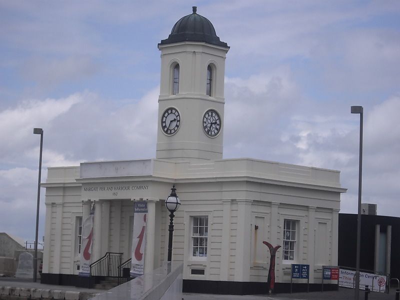
Droit House
TR 3571 SW 2/276
II
2.
A reconstruction after storm damage of an original building of 1812. 1
storey stuccoed and rusticated. Central cupola with clock. Parapet. 2
sashes with glazing bars intact. Central porch with 4 fluted Doric columns.
8 simple pilasters.
Listing NGR: TR3533171220
External links are from the relevant listing authority and, where applicable, Wikidata. Wikidata IDs may be related buildings as well as this specific building. If you want to add or update a link, you will need to do so by editing the Wikidata entry.


Other nearby listed buildings
