Approximate Location Map
Large Map »
Latitude: 52.7177 / 52°43'3"N
Longitude: -2.4793 / 2°28'45"W
OS Eastings: 367717
OS Northings: 313442
OS Grid: SJ677134
Mapcode National: GBR BW.1Y1R
Mapcode Global: WH9CW.WYJG
Plus Code: 9C4VPG9C+37
Entry Name: Hadley Park Windmill
Listing Date: 8 April 1983
Grade: II
Source: Historic England
Source ID: 1207369
English Heritage Legacy ID: 362128
ID on this website: 101207369
Location: Hortonwood, Telford and Wrekin, Shropshire, TF1
County: Telford and Wrekin
Civil Parish: Hadley & Leegomery
Built-Up Area: Telford
Traditional County: Shropshire
Lieutenancy Area (Ceremonial County): Shropshire
Church of England Parish: Hadley Holy Trinity
Church of England Diocese: Lichfield
Tagged with: Windmill
SJ 61 SE; 28/263
HORTONWOOD,
HADLEY PARK,
Hadley Park Lane,
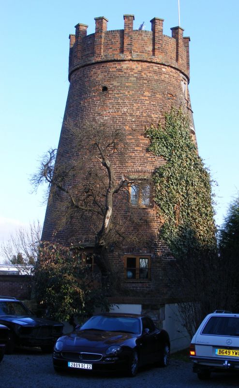
Hadley Park Windmill
II
Circa late C18 tower mill, converted to watermill. Red brick tapered circular
tower. The cap has been replaced by a crenellated parapet in circa late C19.
Some machinery of both wind and water power remains inside.
Listing NGR: SJ6771713442
External links are from the relevant listing authority and, where applicable, Wikidata. Wikidata IDs may be related buildings as well as this specific building. If you want to add or update a link, you will need to do so by editing the Wikidata entry.


Other nearby listed buildings
