Approximate Location Map
Large Map »
Latitude: 51.1105 / 51°6'37"N
Longitude: -0.1998 / 0°11'59"W
OS Eastings: 526113
OS Northings: 136119
OS Grid: TQ261361
Mapcode National: GBR JKK.B9F
Mapcode Global: VHGSW.HC71
Plus Code: 9C3X4R62+63
Entry Name: Goffs Manor
Listing Date: 11 February 1960
Grade: II
Source: Historic England
Source ID: 1207575
English Heritage Legacy ID: 363359
ID on this website: 101207575
Location: Southgate, Crawley, West Sussex, RH11
County: West Sussex
District: Crawley
Electoral Ward/Division: Southgate
Parish: Non Civil Parish
Built-Up Area: Crawley
Traditional County: Sussex
Lieutenancy Area (Ceremonial County): West Sussex
Church of England Parish: Crawley St John the Baptist
Church of England Diocese: Chichester
Tagged with: Manor house
HORSHAM ROAD
1.
5403
Southgate
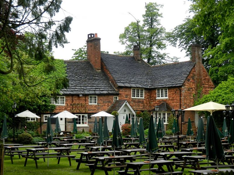
Goffs Manor
TQ 23 NE 3/37 11.2.60
II
2.
L-shaped C16 timber-framed farmhouse the first floor now tile-hung but the framing
still visible on the ground floor with brick infilling. Two storeys, 4 casement
windows. Horsham slab roof. C19 gabled porch. Ceiling beams and open fireplace
inside.
Listing NGR: TQ2611336119
External links are from the relevant listing authority and, where applicable, Wikidata. Wikidata IDs may be related buildings as well as this specific building. If you want to add or update a link, you will need to do so by editing the Wikidata entry.


Other nearby listed buildings
