Approximate Location Map
Large Map »
Latitude: 54.0485 / 54°2'54"N
Longitude: -2.805 / 2°48'18"W
OS Eastings: 347388
OS Northings: 461687
OS Grid: SD473616
Mapcode National: GBR 8PVM.JH
Mapcode Global: WH846.WHGR
Plus Code: 9C6V25XV+9X
Entry Name: Gate Piers, Steps and Wall Opposite Junction with Dallas Road
Listing Date: 13 March 1995
Grade: II
Source: Historic England
Source ID: 1211539
English Heritage Legacy ID: 383213
ID on this website: 101211539
Location: Lancaster, Lancashire, LA1
County: Lancashire
District: Lancaster
Electoral Ward/Division: Castle
Parish: Non Civil Parish
Built-Up Area: Lancaster
Traditional County: Lancashire
Lieutenancy Area (Ceremonial County): Lancashire
Church of England Parish: Lancaster St Mary with St John and St Anne
Church of England Diocese: Blackburn
Tagged with: Gatepost
LANCASTER
SD4761NW MEETING HOUSE LANE
1685-1/6/180 (North side)
Gate piers, steps and wall opposite
junction with Dallas Road
II
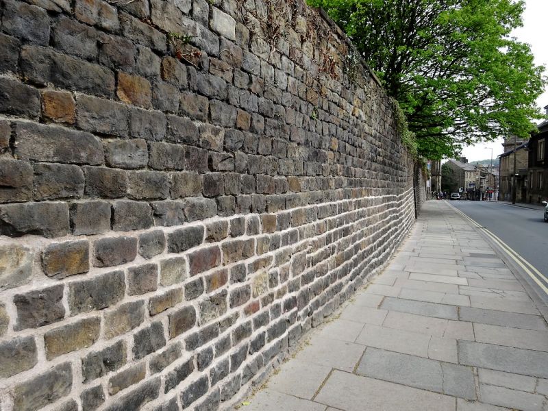
Pair of gate piers, steps and retaining wall to the terraced
gardens of Nos 20 & 22 Castle Park (qv). Mid C18, altered
c1866. One of 3 flights laid out by Allan Harrison in his
extended garden. Sandstone ashlar and coursed and squared
rubble. The piers are square in plan with a pilaster on each
face and have a pronounced cornice. The eastern pier is topped
by an urn on an elaborately moulded base, the urn to the
western pier was removed c1990. The gate piers now stand at
the top of a flight of plain C19 steps and at the bottom of a
flight of 15 mid C18 steps with nosings. The retaining walls
are battered and watershot, approx 4m high, and extend approx
20m westwards from the bottom of the steps and 15m eastwards.
HISTORY: Meeting House Lane was widened in 1866 to cope with
the increased traffic generated by the railway station, and
consequently the wall was rebuilt approx 5m north of its
original alignment.
Listing NGR: SD4738861687
External links are from the relevant listing authority and, where applicable, Wikidata. Wikidata IDs may be related buildings as well as this specific building. If you want to add or update a link, you will need to do so by editing the Wikidata entry.


Other nearby listed buildings
