Approximate Location Map
Large Map »
Latitude: 54.4013 / 54°24'4"N
Longitude: -0.9609 / 0°57'39"W
OS Eastings: 467553
OS Northings: 501140
OS Grid: NZ675011
Mapcode National: GBR PKQK.R1
Mapcode Global: WHF91.6MPS
Plus Code: 9C6XC22Q+GJ
Entry Name: Boundary Stone
Listing Date: 27 August 1987
Grade: II
Source: Historic England
Source ID: 1213960
English Heritage Legacy ID: 382489
ID on this website: 101213960
Location: North Yorkshire, YO62
County: North Yorkshire
District: Ryedale
Civil Parish: Rosedale West Side
Traditional County: Yorkshire
Lieutenancy Area (Ceremonial County): North Yorkshire
Church of England Parish: Lastingham St Mary
Church of England Diocese: York
Tagged with: Boundary marker
ROSEDALE WEST SIDE BLAKEY RIDGE
NZ 60 SE
(east side, off)
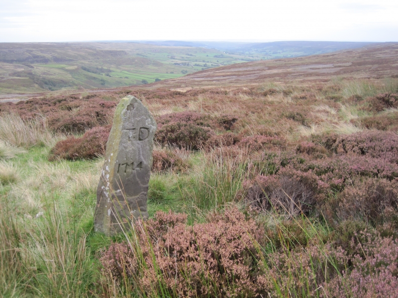
1/71 Boundary stone
- II
Boundary stone. 1714. Stone. Roughly-shaped monolith approximately
1.2 metres high. West face inscribed: TD
1714
TD stood for Thomas Duncombe, former Lord of the Manor of Helmsley.
Listing NGR: NZ6755301140
External links are from the relevant listing authority and, where applicable, Wikidata. Wikidata IDs may be related buildings as well as this specific building. If you want to add or update a link, you will need to do so by editing the Wikidata entry.


Other nearby listed buildings
