Approximate Location Map
Large Map »
Latitude: 51.2736 / 51°16'24"N
Longitude: 0.5218 / 0°31'18"E
OS Eastings: 575999
OS Northings: 155738
OS Grid: TQ759557
Mapcode National: GBR PR7.0RJ
Mapcode Global: VHJMF.076Z
Plus Code: 9F327GFC+CP
Entry Name: 13, High Street
Listing Date: 2 August 1974
Grade: II
Source: Historic England
Source ID: 1223200
English Heritage Legacy ID: 173339
ID on this website: 101223200
Location: Maidstone, Kent, ME14
County: Kent
District: Maidstone
Electoral Ward/Division: High Street
Parish: Non Civil Parish
Built-Up Area: Maidstone
Traditional County: Kent
Lieutenancy Area (Ceremonial County): Kent
Tagged with: Building
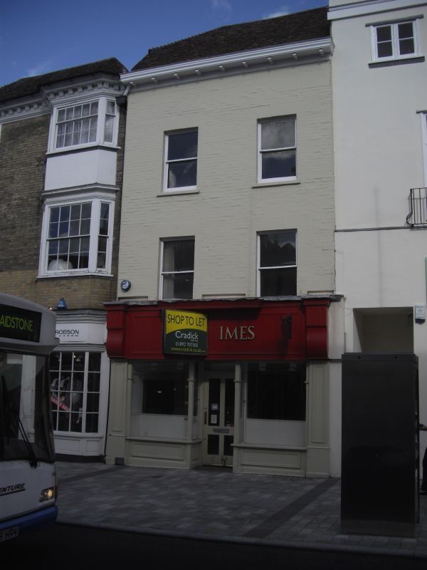
HIGH STREET
1.
5278
(North-West Side)
No 13
TQ 7555 NE 1/270
TQ 7655 NW 2/270
II GV
2.
Early C19. 3 storeys painted brick. Old tiled roof with bracket eaves cornice.
1/2 hipped on the left hand side. 2 sashes without glazing bars. Later shopfront.
Nos 12 to 17 (consec) form a group.
Listing NGR: TQ7599755741
External links are from the relevant listing authority and, where applicable, Wikidata. Wikidata IDs may be related buildings as well as this specific building. If you want to add or update a link, you will need to do so by editing the Wikidata entry.


Other nearby listed buildings
