Approximate Location Map
Large Map »
Latitude: 50.7264 / 50°43'35"N
Longitude: -3.5384 / 3°32'18"W
OS Eastings: 291509
OS Northings: 92996
OS Grid: SX915929
Mapcode National: GBR P0.PPW7
Mapcode Global: FRA 37G5.59R
Plus Code: 9C2RPFG6+HJ
Entry Name: 42, St Davids Hill
Listing Date: 18 June 1974
Grade: II
Source: Historic England
Source ID: 1223560
English Heritage Legacy ID: 419312
ID on this website: 101223560
Location: Exeter, Devon, EX4
County: Devon
District: Exeter
Electoral Ward/Division: St David's
Parish: Non Civil Parish
Built-Up Area: Exeter
Traditional County: Devon
Lieutenancy Area (Ceremonial County): Devon
Church of England Parish: Exeter St David
Church of England Diocese: Exeter
Tagged with: Building
ST DAVID'S HILL
1.
1092
(East Side)
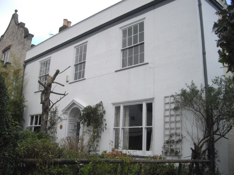
No 42
SX 9193 SE 1/126
SX 9192 NE 21/126
SX 9193 11/126
SX 99 SW 24/126
II
2.
2 storey, 3 window, late C18 stucco front. 3-light sash windows, glazing bars
removed to ground floor. Gothic window at side. Pedimented doorcase with fluted
pilasters and panelled reveals. Cornice, parapet, hipped slate roof.
Listing NGR: SX9150992996
External links are from the relevant listing authority and, where applicable, Wikidata. Wikidata IDs may be related buildings as well as this specific building. If you want to add or update a link, you will need to do so by editing the Wikidata entry.


Other nearby listed buildings
