Approximate Location Map
Large Map »
Latitude: 50.6796 / 50°40'46"N
Longitude: -3.4631 / 3°27'47"W
OS Eastings: 296726
OS Northings: 87676
OS Grid: SX967876
Mapcode National: GBR P3.3SBQ
Mapcode Global: FRA 37M8.YF9
Plus Code: 9C2RMGHP+RQ
Entry Name: 20-22, the Strand
Listing Date: 18 June 1974
Grade: II
Source: Historic England
Source ID: 1223960
English Heritage Legacy ID: 419900
ID on this website: 101223960
Location: Topsham, Exeter, Devon, EX3
County: Devon
District: Exeter
Electoral Ward/Division: Topsham
Parish: Non Civil Parish
Built-Up Area: Topsham
Traditional County: Devon
Lieutenancy Area (Ceremonial County): Devon
Church of England Parish: Topsham St Margaret
Church of England Diocese: Exeter
Tagged with: House
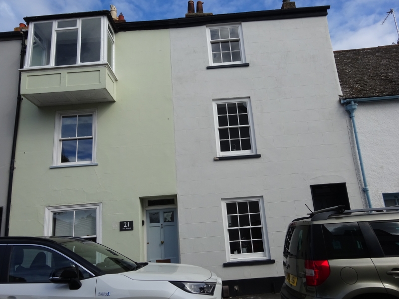
THE STRAND
1.
1092
(East Side)
TOPSHAM
Nos 20 to 22 (consec)
SX 9688 9/1171
II GV
2.
Early/Mid C19. Nos 20 and 21 altered. Limestone, rendered. Three storeys,
one window each, C19 sashes to Nos 20 and 21, also one projecting bay;
No 20 has sashes with glazing bars. Plain doors. Roof not visible from
street.
All the listed buildings of the Strand form a group.
Listing NGR: SX9672687676
External links are from the relevant listing authority and, where applicable, Wikidata. Wikidata IDs may be related buildings as well as this specific building. If you want to add or update a link, you will need to do so by editing the Wikidata entry.


Other nearby listed buildings
