Approximate Location Map
Large Map »
Latitude: 50.7235 / 50°43'24"N
Longitude: -3.5322 / 3°31'55"W
OS Eastings: 291945
OS Northings: 92661
OS Grid: SX919926
Mapcode National: GBR P0.PZJD
Mapcode Global: FRA 37H5.FR3
Plus Code: 9C2RPFF9+94
Entry Name: 17, Waterbeer Street
Listing Date: 18 June 1974
Grade: II
Source: Historic England
Source ID: 1224260
English Heritage Legacy ID: 420272
ID on this website: 101224260
Location: Exeter, Devon, EX4
County: Devon
District: Exeter
Electoral Ward/Division: St David's
Parish: Non Civil Parish
Built-Up Area: Exeter
Traditional County: Devon
Lieutenancy Area (Ceremonial County): Devon
Church of England Parish: Central Exeter
Church of England Diocese: Exeter
Tagged with: Building
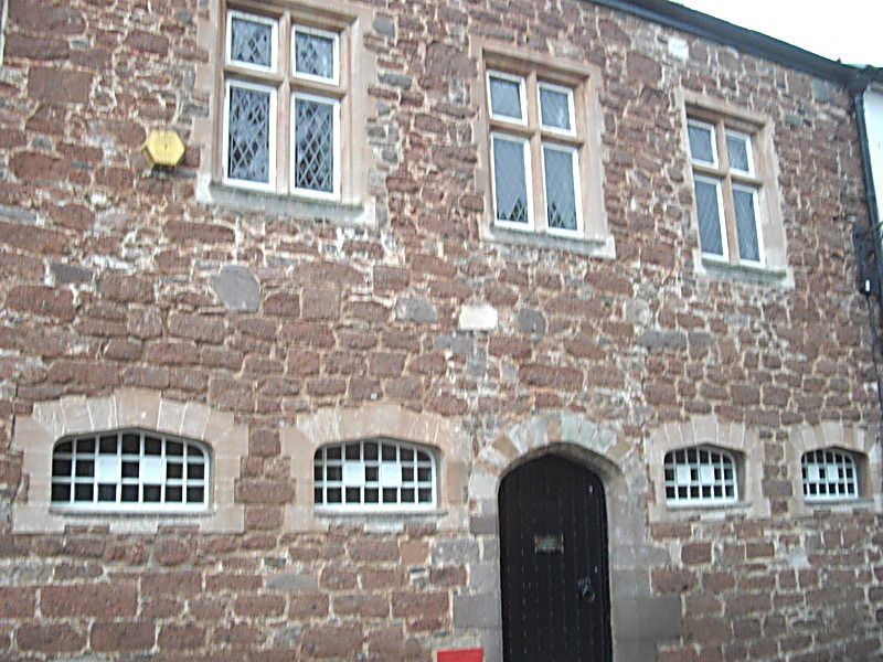
WATERBEER STREET
1.
1092
No 17
SX 9192 NE 2/1216
II GV
2.
C19 and earlier. Heavitree stone. Two storeys, four windows, lunettes and arched
doorway on ground floor. Three stone mullion and transom windows above. Slate
roof.
All the listed buildings in Waterbeer Street form a group.
Listing NGR: SX9194292656
External links are from the relevant listing authority and, where applicable, Wikidata. Wikidata IDs may be related buildings as well as this specific building. If you want to add or update a link, you will need to do so by editing the Wikidata entry.


Other nearby listed buildings
