Approximate Location Map
Large Map »
Latitude: 51.2671 / 51°16'1"N
Longitude: 0.5271 / 0°31'37"E
OS Eastings: 576395
OS Northings: 155023
OS Grid: TQ763550
Mapcode National: GBR PR7.G2T
Mapcode Global: VHJMF.3F00
Plus Code: 9F327G8G+RR
Entry Name: 135-141, Upper Stone Street
Listing Date: 2 August 1974
Grade: II
Source: Historic England
Source ID: 1225552
English Heritage Legacy ID: 421907
ID on this website: 101225552
Location: Maidstone, Kent, ME15
County: Kent
District: Maidstone
Electoral Ward/Division: High Street
Parish: Non Civil Parish
Built-Up Area: Maidstone
Traditional County: Kent
Lieutenancy Area (Ceremonial County): Kent
Tagged with: Building
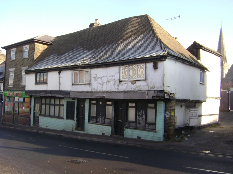
UPPER STONE STREET
1.
5278
(East Side)
Nos 135 to 141 (odd)
TQ 7655 SW 7/59
II
2.
One building new sub-divided. Atimber-framed structure of 2 storeys refronted
with stucco but retainint the overhang of the lst floor. Tiled roof hipped
at the south end. Modern casement windows and shopfront.
Listing NGR: TQ7639555023
External links are from the relevant listing authority and, where applicable, Wikidata. Wikidata IDs may be related buildings as well as this specific building. If you want to add or update a link, you will need to do so by editing the Wikidata entry.


Other nearby listed buildings
