Approximate Location Map
Large Map »
Latitude: 51.2274 / 51°13'38"N
Longitude: -0.3367 / 0°20'12"W
OS Eastings: 516234
OS Northings: 148892
OS Grid: TQ162488
Mapcode National: GBR HGH.ZM7
Mapcode Global: VHGS7.3DTX
Plus Code: 9C3X6MG7+X8
Entry Name: The Highlands
Listing Date: 11 June 1973
Grade: II
Source: Historic England
Source ID: 1229826
English Heritage Legacy ID: 404650
ID on this website: 101229826
Location: Rose Hill, Mole Valley, Surrey, RH4
County: Surrey
District: Mole Valley
Electoral Ward/Division: Dorking South
Parish: Non Civil Parish
Built-Up Area: Dorking
Traditional County: Surrey
Lieutenancy Area (Ceremonial County): Surrey
Church of England Parish: Dorking St Martin
Church of England Diocese: Guildford
Tagged with: Architectural structure
VINCENT LANE
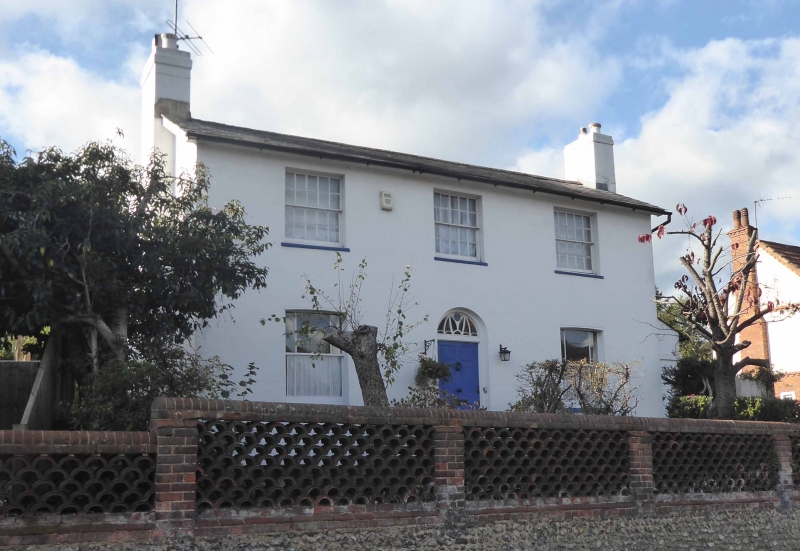
1.
1049
The Highland
TQ 1648 5/53
II
2.
Circa 1830. 2 storeys. 3 windows. Stuccoed. Eaves cornice. Slate roof.
Glazing bars intact on 1st floor only. Round-headed doorway with semi-circular
fanlight with tracery intact. 2 parallel ranges. Photograph in NMR.
Listing NGR: TQ1623448892
External links are from the relevant listing authority and, where applicable, Wikidata. Wikidata IDs may be related buildings as well as this specific building. If you want to add or update a link, you will need to do so by editing the Wikidata entry.


Other nearby listed buildings
