Approximate Location Map
Large Map »
Latitude: 50.7214 / 50°43'17"N
Longitude: -3.5345 / 3°32'4"W
OS Eastings: 291776
OS Northings: 92433
OS Grid: SX917924
Mapcode National: GBR P0.Q4XX
Mapcode Global: FRA 37H5.DV7
Plus Code: 9C2RPFC8+H5
Entry Name: 1 and 2, the Mint
Listing Date: 18 June 1974
Grade: II
Source: Historic England
Source ID: 1239751
English Heritage Legacy ID: 417735
ID on this website: 101239751
Location: Exeter, Devon, EX4
County: Devon
District: Exeter
Electoral Ward/Division: St David's
Parish: Non Civil Parish
Built-Up Area: Exeter
Traditional County: Devon
Lieutenancy Area (Ceremonial County): Devon
Church of England Parish: Central Exeter
Church of England Diocese: Exeter
Tagged with: Building
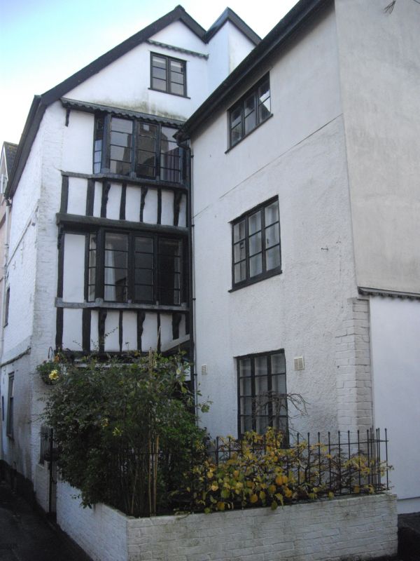
THE MINT
1.
1092
Nos 1 and 2
SX 9192 SE 5/306
II
2.
C16/C17. Brick and timber-framing. Four storeys. Gabled north side has oriels
on brackets to the first and second floors. Late Georgian doorway and sash windows,
Asbestos tile roof with gabled dormers and a bargeboarded gable.
Listing NGR: SX9177692433
External links are from the relevant listing authority and, where applicable, Wikidata. Wikidata IDs may be related buildings as well as this specific building. If you want to add or update a link, you will need to do so by editing the Wikidata entry.


Other nearby listed buildings
