Approximate Location Map
Large Map »
Latitude: 51.2789 / 51°16'43"N
Longitude: 1.0797 / 1°4'47"E
OS Eastings: 614886
OS Northings: 157810
OS Grid: TR148578
Mapcode National: GBR TY2.PT3
Mapcode Global: VHLGM.N3PY
Plus Code: 9F3373HH+HV
Entry Name: Building to Rear of No 44
Listing Date: 7 September 1973
Grade: II
Source: Historic England
Source ID: 1240760
English Heritage Legacy ID: 439272
ID on this website: 101240760
Location: Canterbury, Kent, CT1
County: Kent
District: Canterbury
Electoral Ward/Division: Westgate
Parish: Non Civil Parish
Built-Up Area: Canterbury
Traditional County: Kent
Lieutenancy Area (Ceremonial County): Kent
Tagged with: Building
1.
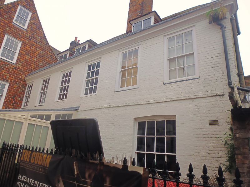
944 HIGH STREET
(South West Side)
Building to rear of No 44
TR 1457 NE 4/513
II
2.
C18. 2 storeys painted brick. Tiled roof with 3 hipped dormers. Wide moulded
eaves cornice. 4 sashes with glazing bars intact and 2 blanks. Ground floor
has traces of early C18 panelling. Probably once part of the Crown Inn.
Listing NGR: TR1488657810
External links are from the relevant listing authority and, where applicable, Wikidata. Wikidata IDs may be related buildings as well as this specific building. If you want to add or update a link, you will need to do so by editing the Wikidata entry.


Other nearby listed buildings
