Approximate Location Map
Large Map »
Latitude: 51.2771 / 51°16'37"N
Longitude: 1.0855 / 1°5'7"E
OS Eastings: 615296
OS Northings: 157628
OS Grid: TR152576
Mapcode National: GBR TY2.Z4D
Mapcode Global: VHLGM.R5Q9
Plus Code: 9F3373GP+R6
Entry Name: 8-12, Ivy Lane
Listing Date: 7 September 1973
Grade: II
Source: Historic England
Source ID: 1240823
English Heritage Legacy ID: 439378
ID on this website: 101240823
Location: Canterbury, Kent, CT1
County: Kent
District: Canterbury
Electoral Ward/Division: Barton
Parish: Non Civil Parish
Built-Up Area: Canterbury
Traditional County: Kent
Lieutenancy Area (Ceremonial County): Kent
Tagged with: Building
1.
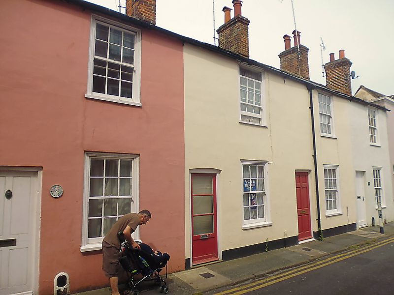
944 IVY LANE
(North side)
Nos 8 to 12 (consec)
TR 1557 NW 5/516
II GV
2.
Late C18 to early C19. 2 storeys stuccoed. Tiled roof with 4 brick stacks.
4 sashes with glazing bars intact set in moulded architraves. Simple doorcases.
Only No 8 is original. No 12 has a parapet. Grade II as a group.
Nos 7 to 13 (consec) form a group.
Listing NGR: TR1529657630
External links are from the relevant listing authority and, where applicable, Wikidata. Wikidata IDs may be related buildings as well as this specific building. If you want to add or update a link, you will need to do so by editing the Wikidata entry.


Other nearby listed buildings
