Approximate Location Map
Large Map »
Latitude: 51.2768 / 51°16'36"N
Longitude: 1.087 / 1°5'13"E
OS Eastings: 615402
OS Northings: 157595
OS Grid: TR154575
Mapcode National: GBR TY2.ZKF
Mapcode Global: VHLGM.S5JK
Plus Code: 9F3373GP+PR
Entry Name: 40A and 41, Ivy Lane
Listing Date: 3 December 1949
Grade: II
Source: Historic England
Source ID: 1240824
English Heritage Legacy ID: 439380
ID on this website: 101240824
Location: St Martin's, Canterbury, Kent, CT1
County: Kent
District: Canterbury
Electoral Ward/Division: Barton
Parish: Non Civil Parish
Built-Up Area: Canterbury
Traditional County: Kent
Lieutenancy Area (Ceremonial County): Kent
Tagged with: Building
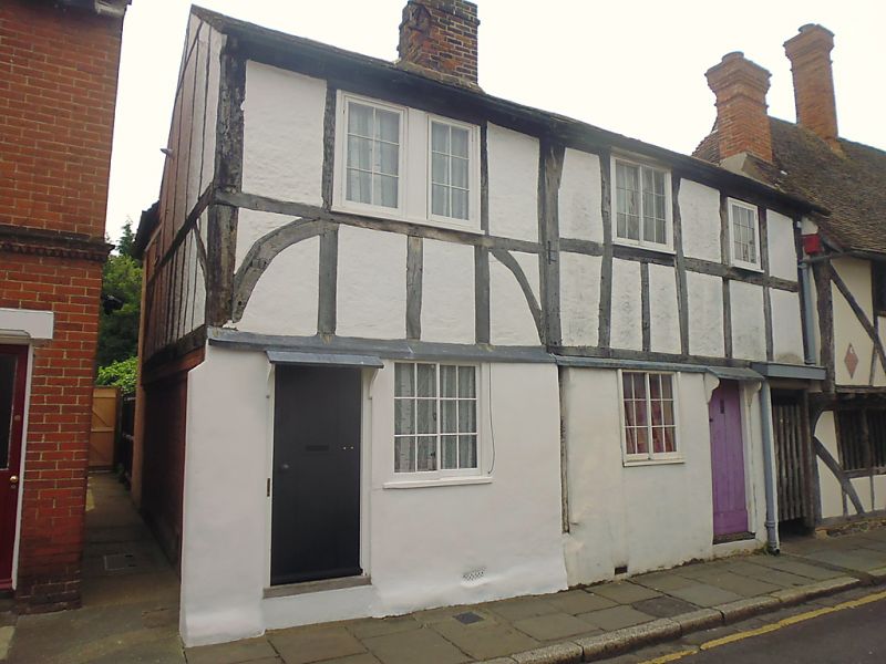
1.
944 IVY LANE
(South Side)
Nos 40A and 41
TR 1557 NW 5/165 3.12.49.
II GV
2.
C16. 2 storeys timber-framed with plaster infill. Old tiled roof, Some
curved braces. Windows are restored casements. 2 simple C19 wooden doors
with wooden weatherhoods on brackets.
Nos 40A to 45 (consec), No 51, Nos 51A, Nos 53 to 61 (consec) and
No 63 form a group.
Listing NGR: TR1539957591
External links are from the relevant listing authority and, where applicable, Wikidata. Wikidata IDs may be related buildings as well as this specific building. If you want to add or update a link, you will need to do so by editing the Wikidata entry.


Other nearby listed buildings
