Approximate Location Map
Large Map »
Latitude: 51.2836 / 51°17'0"N
Longitude: 1.0698 / 1°4'11"E
OS Eastings: 614173
OS Northings: 158301
OS Grid: TR141583
Mapcode National: GBR TY2.F96
Mapcode Global: VHLGF.HZFX
Plus Code: 9F3373M9+CW
Entry Name: 79, London Road
Listing Date: 7 September 1973
Grade: II
Source: Historic England
Source ID: 1241028
English Heritage Legacy ID: 439654
ID on this website: 101241028
Location: St Dunstan's, Canterbury, Kent, CT2
County: Kent
District: Canterbury
Electoral Ward/Division: Westgate
Parish: Non Civil Parish
Built-Up Area: Canterbury
Traditional County: Kent
Lieutenancy Area (Ceremonial County): Kent
Tagged with: Building
1.
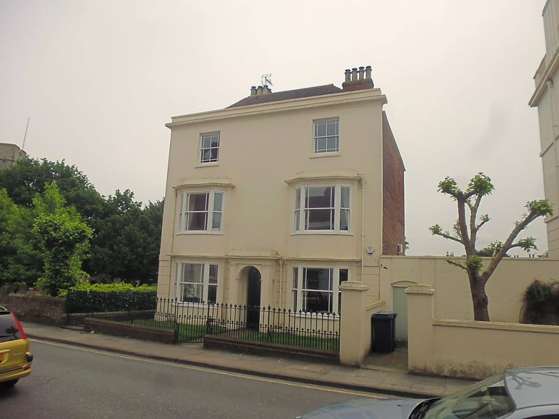
944 LONDON ROAD
(South East Side)
No 79
TR 1458 SW 1/546
II GV
2,
Early C19. 3 storeys stuccoed. Hipped slate roof. 2 sashes. 2 3 light bays
through ground and lst storeys. Ground floor is rusticated. Central porch
has plain pilasters, round-headed fanlight and fielded panelled door.
Nos 66A to 79 (consec) form a group.
Listing NGR: TR1417458298
External links are from the relevant listing authority and, where applicable, Wikidata. Wikidata IDs may be related buildings as well as this specific building. If you want to add or update a link, you will need to do so by editing the Wikidata entry.


Other nearby listed buildings
