Approximate Location Map
Large Map »
Latitude: 51.2825 / 51°16'56"N
Longitude: 1.0835 / 1°5'0"E
OS Eastings: 615132
OS Northings: 158220
OS Grid: TR151582
Mapcode National: GBR TY2.JRV
Mapcode Global: VHLGM.Q1N5
Plus Code: 9F3373JM+XC
Entry Name: 67 and 68, Northgate
Listing Date: 7 September 1973
Grade: II
Source: Historic England
Source ID: 1241067
English Heritage Legacy ID: 439958
ID on this website: 101241067
Location: Northgate, Canterbury, Kent, CT1
County: Kent
District: Canterbury
Electoral Ward/Division: Northgate
Parish: Non Civil Parish
Built-Up Area: Canterbury
Traditional County: Kent
Lieutenancy Area (Ceremonial County): Kent
Tagged with: Building
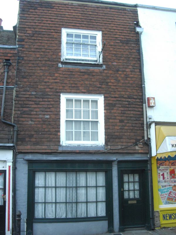
1.
944 NORTHGATE
(North West Side)
Nos 67 and 68
TR 1558 SW 3/257
II GV
2.
C18 fronts. No 67 is stuccoed, No 68 is tile hung. Parapet with coping. Rainwater
head. 1 sash to each with verticals only. 2 sashes to No 67. 19 shop fronts.
Rear elevation has 2 gables.
Nos 60 to 71 (consec) form a group.
Listing NGR: TR1512958224
External links are from the relevant listing authority and, where applicable, Wikidata. Wikidata IDs may be related buildings as well as this specific building. If you want to add or update a link, you will need to do so by editing the Wikidata entry.


Other nearby listed buildings
