Approximate Location Map
Large Map »
Latitude: 51.2805 / 51°16'49"N
Longitude: 1.0799 / 1°4'47"E
OS Eastings: 614892
OS Northings: 157994
OS Grid: TR148579
Mapcode National: GBR TY2.PVQ
Mapcode Global: VHLGM.N2SN
Plus Code: 9F3373JH+6X
Entry Name: 9, Orange Street
Listing Date: 7 September 1973
Grade: II
Source: Historic England
Source ID: 1241376
English Heritage Legacy ID: 440411
ID on this website: 101241376
Location: Canterbury, Kent, CT1
County: Kent
District: Canterbury
Electoral Ward/Division: Westgate
Parish: Non Civil Parish
Built-Up Area: Canterbury
Traditional County: Kent
Lieutenancy Area (Ceremonial County): Kent
Tagged with: Building
1.
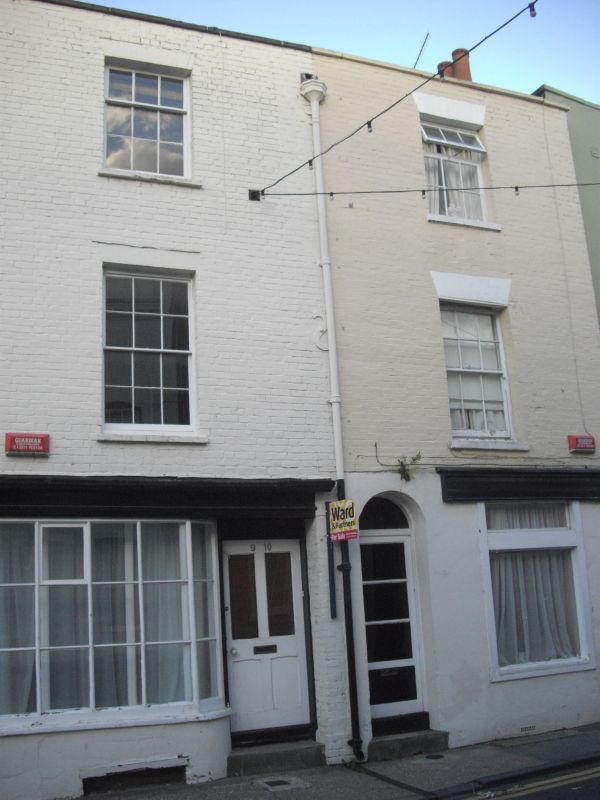
944 ORANGE STREET
(North West Side)
No 9
TR 1457 NE 4/623
II GV
2.
Late C18 facade. 3 storeys buff brick. Stone coping. Rainwater head. 1
sash with glazing bars intact. Early C19 shop front with curved bow and right
side doorcase. The side elevation has a mansard roof and gable end. Pair
with No 10.
Nos 9, 10, Nos 13 to 17 (consec) and Nos 19, 19A and 20 form a group.
Listing NGR: TR1489357994
External links are from the relevant listing authority and, where applicable, Wikidata. Wikidata IDs may be related buildings as well as this specific building. If you want to add or update a link, you will need to do so by editing the Wikidata entry.


Other nearby listed buildings
