Approximate Location Map
Large Map »
Latitude: 51.2801 / 51°16'48"N
Longitude: 1.0805 / 1°4'49"E
OS Eastings: 614935
OS Northings: 157951
OS Grid: TR149579
Mapcode National: GBR TY2.Q0K
Mapcode Global: VHLGM.P23Z
Plus Code: 9F3373JJ+36
Entry Name: 20, Orange Street
Listing Date: 7 September 1973
Grade: II
Source: Historic England
Source ID: 1241382
English Heritage Legacy ID: 440418
ID on this website: 101241382
Location: Canterbury, Kent, CT1
County: Kent
District: Canterbury
Electoral Ward/Division: Westgate
Parish: Non Civil Parish
Built-Up Area: Canterbury
Traditional County: Kent
Lieutenancy Area (Ceremonial County): Kent
Tagged with: Building
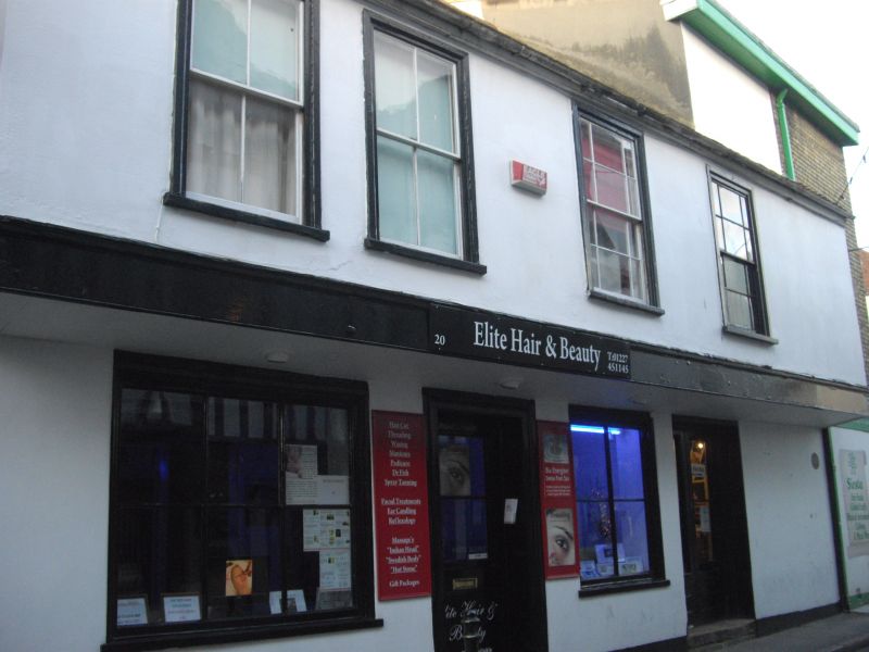
1.
944 ORANGE STREET
(North West Side)
No 20
TR 1457 NE 4/276
II GV
2.
A C17 building much restored. 2 storeys, the ground floor painted brick,
the 1st floor cemented and oversailing. Tiled roof. 4 sashes without glazing
bars. 2 simple recessed doorcases.
Nos 9, 10, Nos 13 to 17 (consec) and Nos 19, 19A and 20 form a group.
Listing NGR: TR1494257947
External links are from the relevant listing authority and, where applicable, Wikidata. Wikidata IDs may be related buildings as well as this specific building. If you want to add or update a link, you will need to do so by editing the Wikidata entry.


Other nearby listed buildings
