Approximate Location Map
Large Map »
Latitude: 51.2828 / 51°16'58"N
Longitude: 1.0716 / 1°4'17"E
OS Eastings: 614303
OS Northings: 158220
OS Grid: TR143582
Mapcode National: GBR TY2.FRR
Mapcode Global: VHLGM.J0DY
Plus Code: 9F3373MC+4M
Entry Name: Vine House
Listing Date: 7 September 1973
Grade: II
Source: Historic England
Source ID: 1241430
English Heritage Legacy ID: 440490
ID on this website: 101241430
Location: St Dunstan's, Canterbury, Kent, CT2
County: Kent
District: Canterbury
Electoral Ward/Division: Westgate
Parish: Non Civil Parish
Built-Up Area: Canterbury
Traditional County: Kent
Lieutenancy Area (Ceremonial County): Kent
Tagged with: House
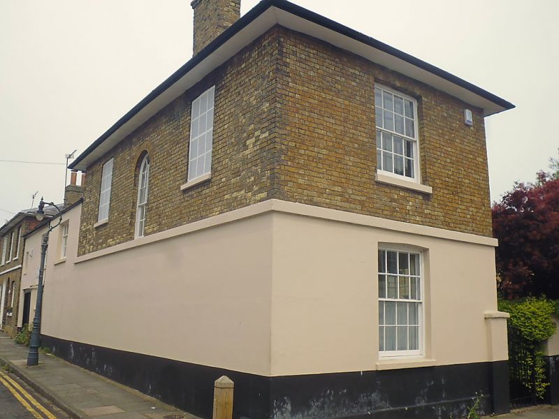
1.
944 ORCHARD STREET
(North West Side)
No 44
(Vine House)
TR 1458 SW 1/640
II
2.
Early C19. 2 storeys gault brick, Ground floor stuccoed. 3 sashes with
glazing bars intact. Hipped slate roofs. Stringcourse. Porch and round-headed
doorcase with 6 panelled doors.
Listing NGR: TR1430358220
External links are from the relevant listing authority and, where applicable, Wikidata. Wikidata IDs may be related buildings as well as this specific building. If you want to add or update a link, you will need to do so by editing the Wikidata entry.


Other nearby listed buildings
