Approximate Location Map
Large Map »
Latitude: 51.2812 / 51°16'52"N
Longitude: 1.0815 / 1°4'53"E
OS Eastings: 614996
OS Northings: 158074
OS Grid: TR149580
Mapcode National: GBR TY2.Q6R
Mapcode Global: VHLGM.P2L4
Plus Code: 9F3373JJ+FH
Entry Name: 19, Palace Street
Listing Date: 7 September 1973
Grade: II
Source: Historic England
Source ID: 1241439
English Heritage Legacy ID: 440505
ID on this website: 101241439
Location: Canterbury, Kent, CT1
County: Kent
District: Canterbury
Electoral Ward/Division: Westgate
Parish: Non Civil Parish
Built-Up Area: Canterbury
Traditional County: Kent
Lieutenancy Area (Ceremonial County): Kent
Tagged with: Building
1.
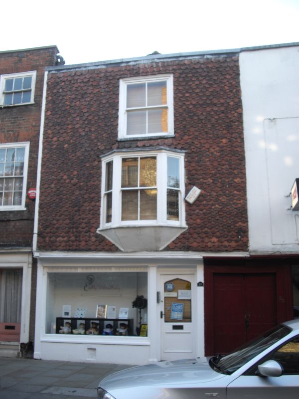
944 PALACE STREET
(West Side)
No 19
TR 1458 SE 2/282
II GV
2.
Early C19 facade to timber-framed building. 3 storeys, hung with fishscale
tiles. 1 C19 sash and a 3 light bay on. the 1st floor. Ground floor has an
early C19 shop front with reeded band and pilasters.
Church of St Alphege and Nos 10 to 28 (consec) form a group.
Listing NGR: TR1499458074
External links are from the relevant listing authority and, where applicable, Wikidata. Wikidata IDs may be related buildings as well as this specific building. If you want to add or update a link, you will need to do so by editing the Wikidata entry.


Other nearby listed buildings
