Approximate Location Map
Large Map »
Latitude: 51.2813 / 51°16'52"N
Longitude: 1.0815 / 1°4'53"E
OS Eastings: 615000
OS Northings: 158082
OS Grid: TR150580
Mapcode National: GBR TY2.Q7T
Mapcode Global: VHLGM.P2M3
Plus Code: 9F3373JJ+GJ
Entry Name: 20, Palace Street
Listing Date: 7 September 1973
Grade: II
Source: Historic England
Source ID: 1241440
English Heritage Legacy ID: 440506
ID on this website: 101241440
Location: Canterbury, Kent, CT1
County: Kent
District: Canterbury
Electoral Ward/Division: Westgate
Parish: Non Civil Parish
Built-Up Area: Canterbury
Traditional County: Kent
Lieutenancy Area (Ceremonial County): Kent
Tagged with: Building
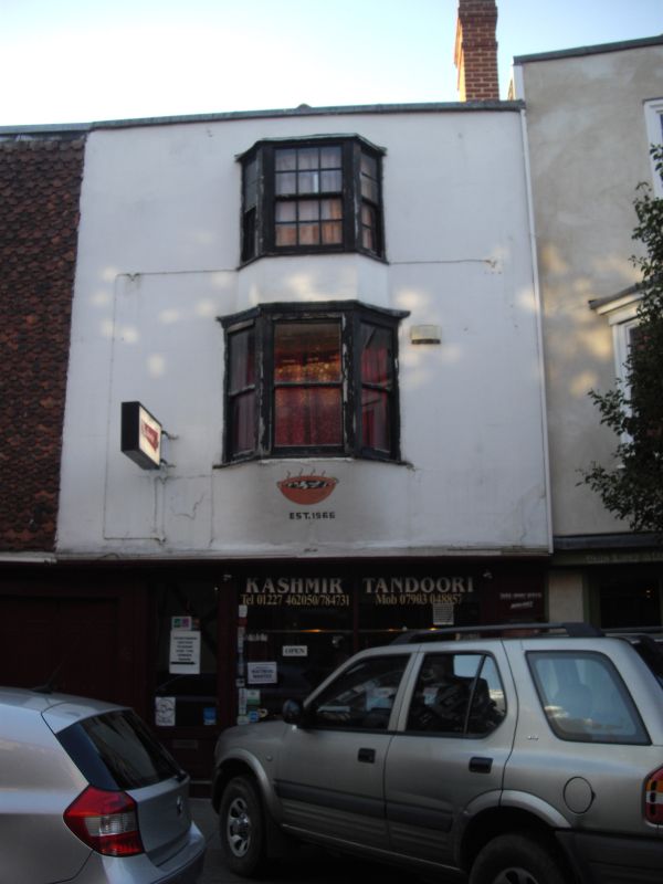
1.
944 PALACE STREET
(West Side)
No 20
TR 1458 SE 2/282
TR 1558 SW 3/282
II GV
2.
Early C19 facade to timber-framed building. 3 storeys colour-washed. Coping.
1 3-light bay with glazing bars intact on 2nd floor only. Early C19 shop
front with panelled risers.
Church of St Alphege and Nos 10 to 28 (consec) form a group.
Listing NGR: TR1500158083
External links are from the relevant listing authority and, where applicable, Wikidata. Wikidata IDs may be related buildings as well as this specific building. If you want to add or update a link, you will need to do so by editing the Wikidata entry.


Other nearby listed buildings
