Approximate Location Map
Large Map »
Latitude: 51.281 / 51°16'51"N
Longitude: 1.0813 / 1°4'52"E
OS Eastings: 614983
OS Northings: 158045
OS Grid: TR149580
Mapcode National: GBR TY2.Q5R
Mapcode Global: VHLGM.P2HB
Plus Code: 9F3373JJ+9G
Entry Name: 13, Palace Street
Listing Date: 3 May 1967
Grade: II
Source: Historic England
Source ID: 1241479
English Heritage Legacy ID: 440499
ID on this website: 101241479
Location: Canterbury, Kent, CT1
County: Kent
District: Canterbury
Electoral Ward/Division: Westgate
Parish: Non Civil Parish
Built-Up Area: Canterbury
Traditional County: Kent
Lieutenancy Area (Ceremonial County): Kent
Tagged with: Building
1.
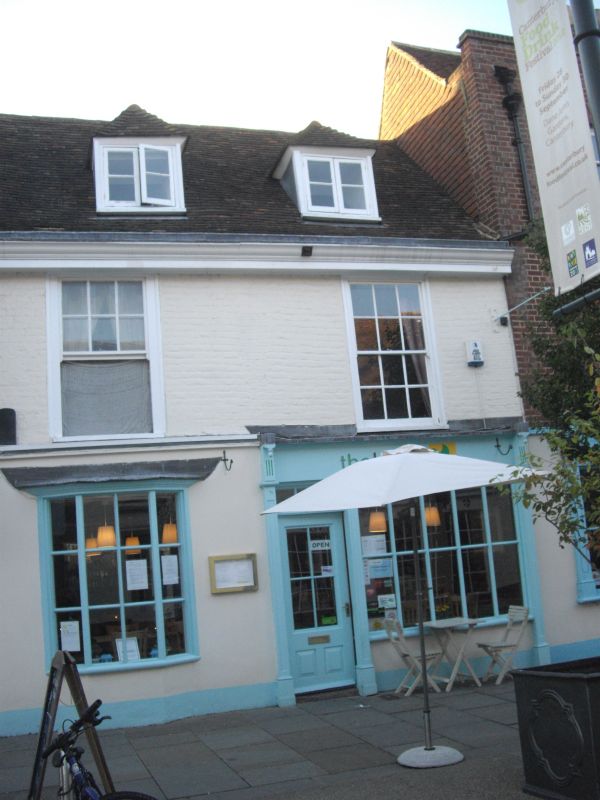
944 PALACE STREET
(West Side)
No 13
TR 1458 SE 2/46 3.5.67.
II GV.
2.
C18. 2 storeys painted brick. Restored tiled roof with 2 hipped dormers.
Moulded wooden eaves cornice. 2 sashes with glazing bars intact. C19 shop
front.
Church of St Alphege and Nos 10 to 28 (consec) form a group.
Listing NGR: TR1498458050
External links are from the relevant listing authority and, where applicable, Wikidata. Wikidata IDs may be related buildings as well as this specific building. If you want to add or update a link, you will need to do so by editing the Wikidata entry.


Other nearby listed buildings
