Approximate Location Map
Large Map »
Latitude: 51.2803 / 51°16'48"N
Longitude: 1.081 / 1°4'51"E
OS Eastings: 614966
OS Northings: 157968
OS Grid: TR149579
Mapcode National: GBR TY2.Q3S
Mapcode Global: VHLGM.P2BW
Plus Code: 9F3373JJ+49
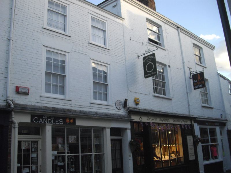
Entry Name: 52 to 54, PALACE STREET
Listing Date: 7 September 1973
Grade: II
Source: Historic England
Source ID: 1241623
English Heritage Legacy ID: 440578
ID on this website: 101241623
Location: Canterbury, Kent, CT1
County: Kent
District: Canterbury
Electoral Ward/Division: Westgate
Parish: Non Civil Parish
Built-Up Area: Canterbury
Traditional County: Kent
Lieutenancy Area (Ceremonial County): Kent
Tagged with: Building
TR 1457 NE 4/52
PALACE STREET
(East Side)Nos 52 to 54 (consec)
GII
C18.Five storeys painted brick.Tiled roof.Rainwater head.One cambered sash with glazing bars intact.No 54 has a later shopfront.Nos 50 to 61 (consec) form a group together with Nos 14 to 24 (consec) Sun Street.
Listing NGR: TR1496857967
External links are from the relevant listing authority and, where applicable, Wikidata. Wikidata IDs may be related buildings as well as this specific building. If you want to add or update a link, you will need to do so by editing the Wikidata entry.


Other nearby listed buildings
