Approximate Location Map
Large Map »
Latitude: 51.283 / 51°16'58"N
Longitude: 1.0724 / 1°4'20"E
OS Eastings: 614351
OS Northings: 158247
OS Grid: TR143582
Mapcode National: GBR TY2.FY4
Mapcode Global: VHLGM.J0RS
Plus Code: 9F3373MC+6W
Entry Name: 51, St Dunstan's Street
Listing Date: 7 September 1973
Grade: II
Source: Historic England
Source ID: 1241866
English Heritage Legacy ID: 441111
ID on this website: 101241866
Location: St Dunstan's, Canterbury, Kent, CT2
County: Kent
District: Canterbury
Electoral Ward/Division: St Stephen's
Parish: Non Civil Parish
Built-Up Area: Canterbury
Traditional County: Kent
Lieutenancy Area (Ceremonial County): Kent
Tagged with: Building
1.
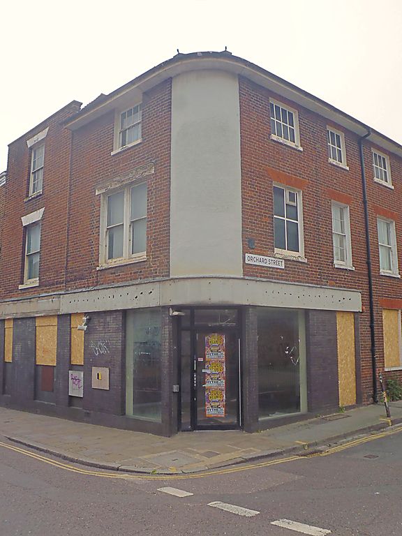
944 ST DUNSTAN'S STREET
(South West Side)
No 5l
TR 1458 SW 1/656
II GV
2.
Mid C19. 3 storeys brick. Hipped slate roof. 1 sash on front elevation,
3 window spaces on the side elevation with some blanks. Some glazing bars
intact. Later shopfront.
Nos 51 to 66 (consec) form a group.
Listing NGR: TR1434558238
External links are from the relevant listing authority and, where applicable, Wikidata. Wikidata IDs may be related buildings as well as this specific building. If you want to add or update a link, you will need to do so by editing the Wikidata entry.


Other nearby listed buildings
